Mass Balance Factsheet for the Maliy Aktru glacier, Altay
The valley-type glacier is located on the northern slope of the North Chuyskiy Range of the Russian Altai Mountains. It extends from 3714 m to 2246 m a.s.l., has a surface area of 2.72 km2 and is exposed to the east and north. It has an average thickness of 90 m (max. 234 m) and its total volume is estimated to be 0.25 km3. Mean annual air temperature at the equilibrium line of the glacier (around 3160 m a.s.l. for balanced conditions) is -9 to -10°C.
The glacier is polythermal and surrounded by continuous to discontinuous permafrost. Average annual precipitation, as measured at 2130 m a.s.l., is about 540 mm. Mass balances of three glaciers within the same basin are being determined.
For additional information on the status of the glacier and on data relating to annual mass balance and other measurements, visit the WGMS Fluctuations of Glaciers Browser.
FACTS:
- Political unit: RU
- WGMS ID: 795
- Latitude: 50.08°N
- Longitude: 87.75°E
- Height min: 2246 m a.s.l.
- Height max: 3714 m a.s.l.
- Measurement types: MASS BALANCE & FRONT VARIATION
- Current Principal Investigator: Yuriy K. Narozhniy & Colleagues
- Current Sponsoring Agency: LABORATORY OF GLACIOCLIMATOLOGY, TOMSK STATE UNIVERSITY

Maliy Aktru glacier in July 2012 (taken by by WIKIMEDIA USER Alexei Rudoy on 18/07/2012)
Terrestrial and satellite map of Maliy Atru glacier (Google Maps)
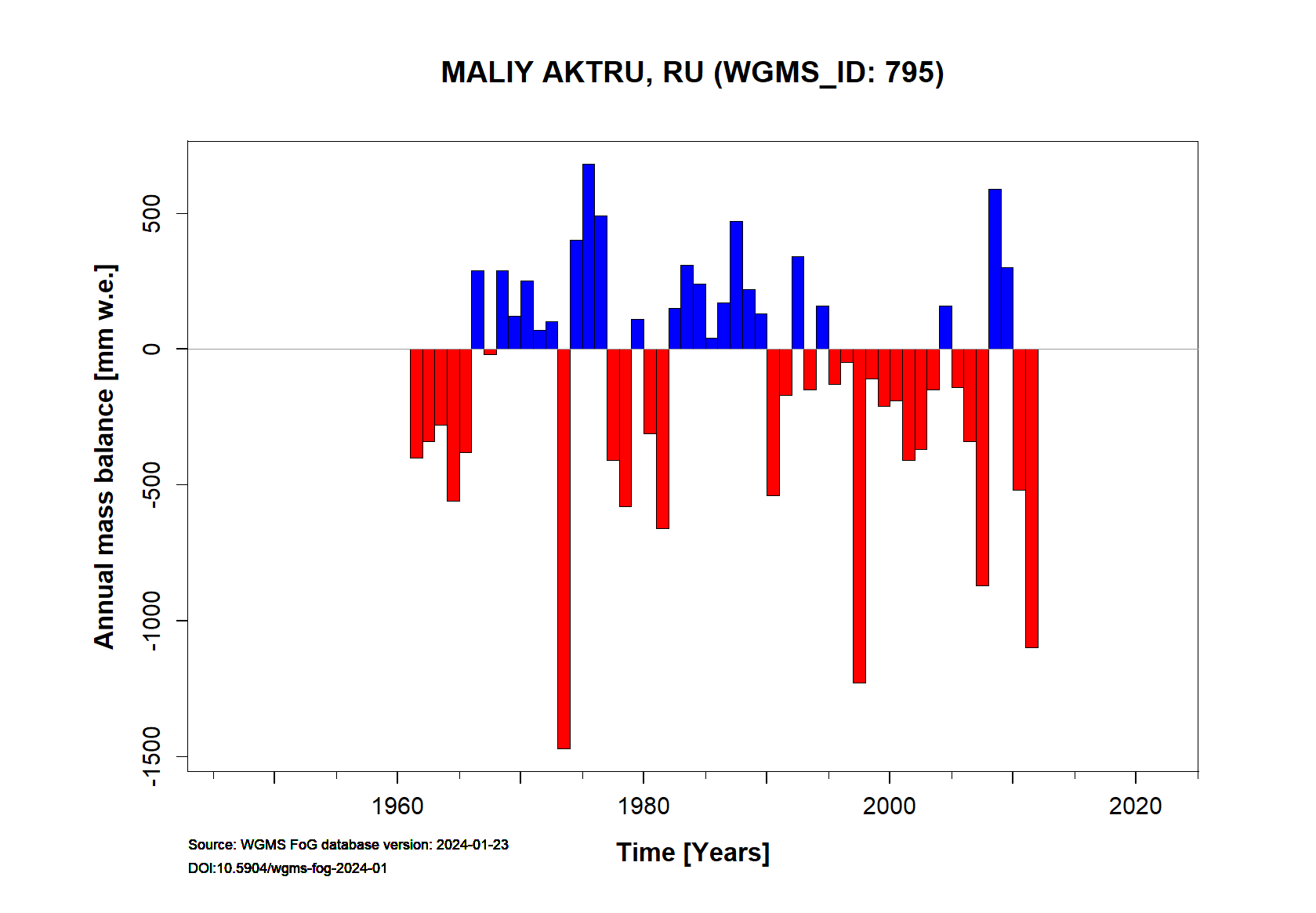
Maliy Aktru glacier Annual Mass Balance (WGMS, 2016)
Continuous Mass Balance (MB) measurements since 1961/62:
![]()
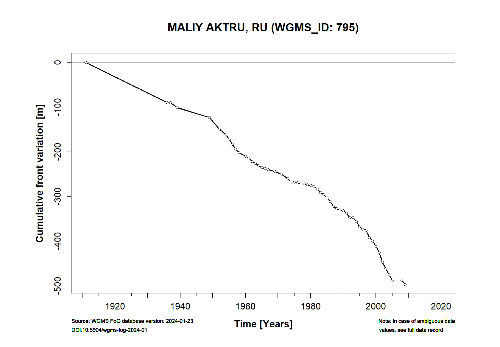
Additional data available: Front Variation (FV), Thickness Change (TC) and Glacier Outlines:

![]()