Mass Balance Factsheet for the Pasterze, Alps
Austria’s largest glacier is located at the foot of Großglockner (3798 m) and is the largest part of a combined mountain glacier system in the Eastern Alps. The total area of Pasterze is 15.3 km² (2018), it covers and altitudinal range from 3500 m to 2100 m a. s. l., is mainly exposed to SE and drains into the Möll river. There is only one narrow connection left between the large accumulation area and the 5 km long and partly debris covered glacier tongue. Geophysical surveys in 1998 revealed a maximum ice thickness of 320 m and a mean ice thickness of 64 m.
Annual mass balance observations have been carried out from 1979/80 to 1996/97 and were resumed in 2004/05. Average annual air temperature at 3100 m (approximate average ELA) is -4.5 °C (1991-2020). Measured average annual precipitation at near Sonnblick is 2560 mm (1991-2020). Since a few years, you can witness the rapid retreat of the glacier snout via a high quality webcam.
For additional information on the status of the glacier and on data relating to annual mass balance and other measurements, visit the WGMS Fluctuations of Glaciers Browser.
FACTS:
- Political unit: AT
- WGMS ID: 566
- Latitude: 47.1°N
- Longitude: 12.7°E
- Height min: 2100 m a.s.l.
- Height max: 3500 m a.s.l.
- Measurement types: MASS BALANCE, THICKNESS CHANGE & FRONT VARIATION
- Current Principal Investigator: Anton Neureiter & colleagues
- Current Sponsoring Agency: GEOSPHERE AUSTRIA, AUSTRIA’S INTEGRATED FEDERAL INSTITUTE OF GEOLOGY, GEOPHYSICS, CLIMATOLOGY AND METEOROLOGY (VIENNA, AT).
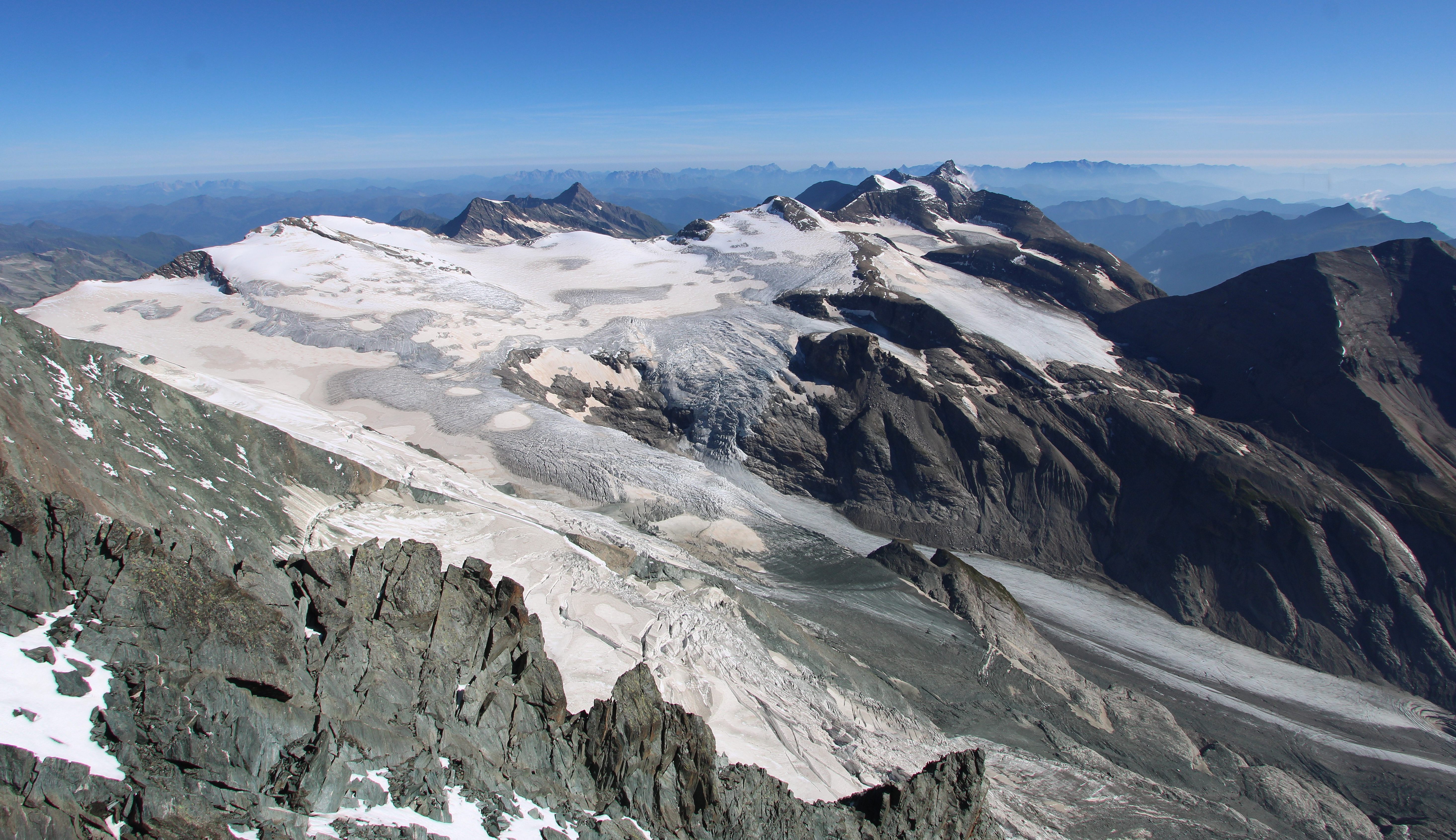
Pasterze in July 2022. (Foto taken from an automatic camera near the summit of Großglockner on 17/7/2022)
Terrestrial and satellite map of Pasterze (Google Maps)
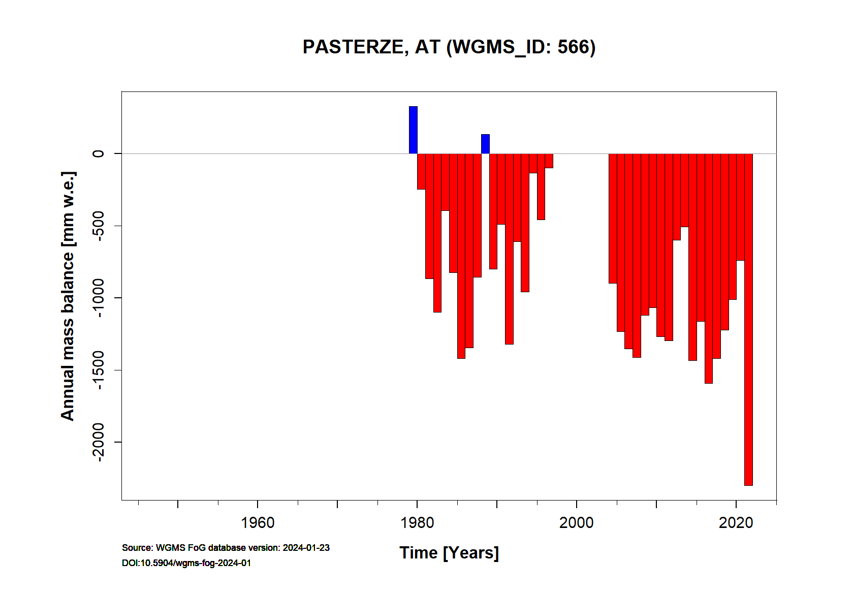
Pasterze Annual Mass Balance (WGMS)
Continuous Mass Balance (MB) measurements since 1979/80:
![]()
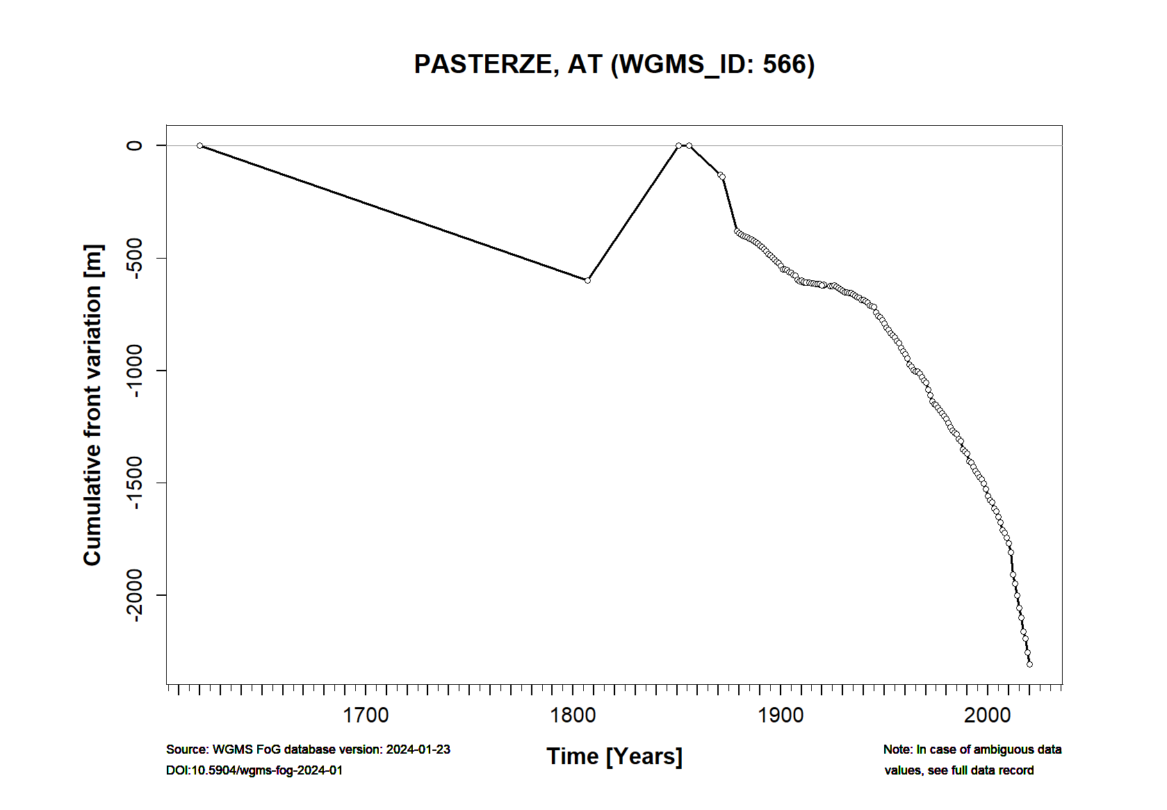
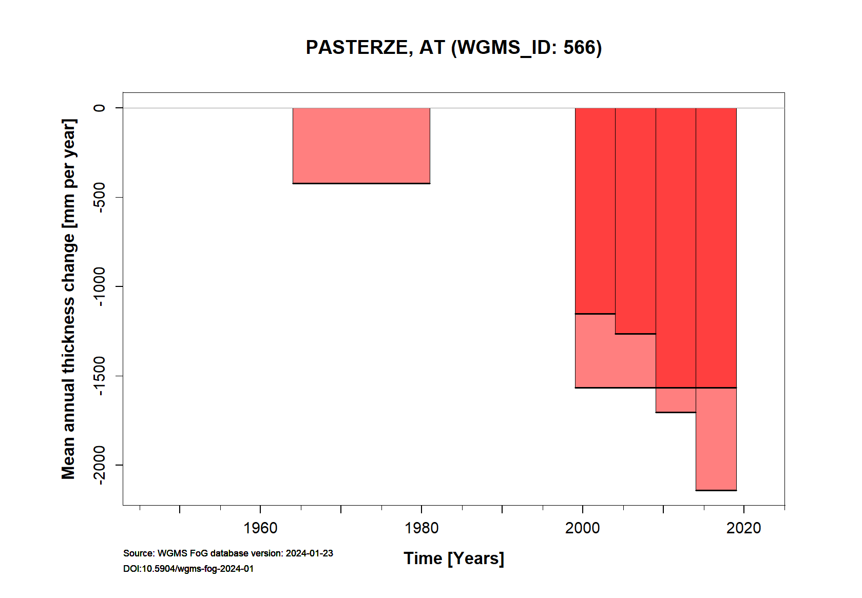
Additional data available: Front Variation (FV), Thickness Change (TC) and Glacier Outlines:


![]()