Mass Balance Factsheet for the Midtre Lovénbreen, Svalbard
Midtre Lovénbreen is situated in the Kongsfjorden area in the north-western part of Spitzbergen, Svalbard. It is a valley glacier extending from 650 to 50 m a.s.l. Its surface area is 5.4 km2 (2011), and it is exposed to the north-east. Average annual precipitation at the nearby meteorological station at NyÅlesund (40 m a.s.l) is just below 400 mm. Annual mean air temperature at the equilibrium line at about 300 m a.s.l. is close to -8°C. Like Austre Brøggerbeen, Midtre Lovénbreen is surrounded by continuous permafrost. However, Lovénbreen is thicker and partly temperate.
For information on the status of the glacier and on data relating to annual mass balance and other measurements, visit the WGMS Fluctuations of Glaciers Browser.
FACTS:
- Political unit: SJ
- WGMS ID: 291
- Latitude: 78.88°N
- Longitude: 12.07°W
- Height min: 50 m a.s.l.
- Height max: 650 m a.s.l.
- Measurement types: MASS BALANCE & THICKNESS CHANGE
- Current Principal Investigator: JACK KOHLER & Colleagues
- Current Sponsoring Agency: NORWEGIAN POLAR INSTITUTE – POLAR ENVIRONMENTAL CENTER (TROMSO, NO)
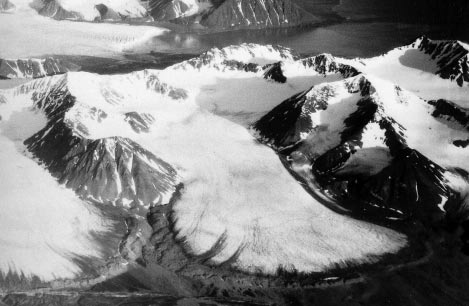
Midtre Lovénbreen in 1999 (taken by Michael Hambrey on 99/99/1999)
Terrestrial and satellite map of Midtre Lovénbreen (Google Maps)

Midtre Lovénbreen Annual Mass Balance (WGMS, 2016)
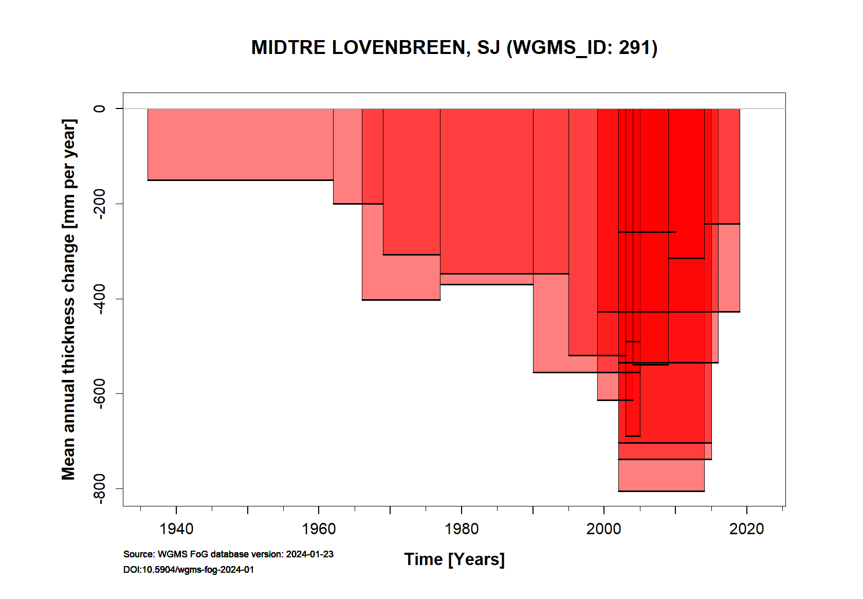
Continuous Mass Balance (MB) measurements since 1967/68:
![]()
Additional data available: Thickness Change (TC) and Glacier Outlines:

![]()