Mass Balance Factsheet for the Meighen Ice Cap, Canadian High Arctic
…tba…
For information on the status of the glacier and on data relating to annual mass balance and other measurements, visit the WGMS Fluctuations of Glaciers Browser.
FACTS:
- Political unit:CA
- WGMS ID: 16
- Latitude: 79.95°N
- Longitude: 99.13°W
- Height min: 70 m a.s.l.
- Height max: 1267 m a.s.l.
- Measurement types: MASS BALANCE
- Current Principal Investigator: DAVID BURGESS & Colleagues
- Current Sponsoring Agency: NATURAL RESOURCES CANADA – GEOLOGICAL SURVEY OF CANADA (OTTAWA, CA)
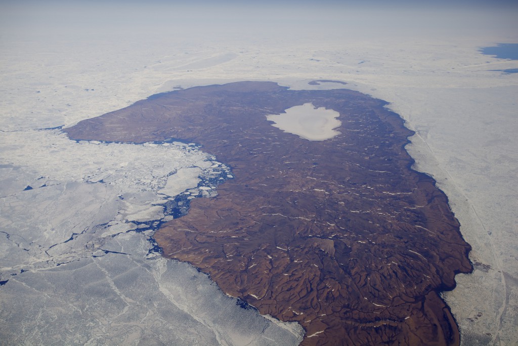
Meighen Ice Cap in 2011 (taken by Jürg Alean on 16/07/2011)
Terrestrial and satellite map of Meighen Ice Cap (Google Maps)
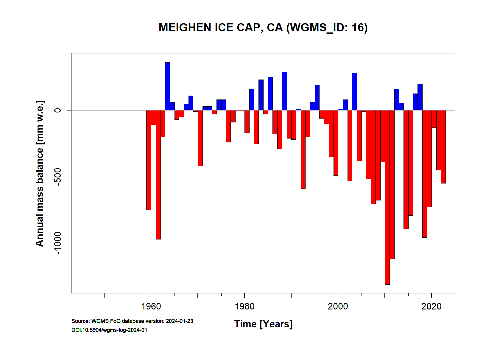
Meighen Ice Cap Annual Mass Balance (WGMS, 2016)
Continuous Mass Balance (MB) measurements since 1959/60:
![]()
Additional data available: Glacier Outlines:
![]()