Mass Balance Factsheet for the Maladeta glacier, Alps
Maladeta Glacier is located in Spain in the mountain massif with the highest peaks in the Pyrenees. In 1992, the glacier separated into two bodies (Eastern and the smallest Western). Both bodies are north-orientated, lying down on the slopes of the Maladeta peak (3308 m a.s.l).
The mass balance of the east Maladeta glacier has been measured with the direct glaciological method since the first installation of ablation stakes in 1991 and with the geodetic ground survey method since 2001.
Maladeta Glacier has lost more than 80% of its area from 1850 to 2021, from about 1.3 km² to 0.22 km². The Maladeta West’s surface is estimated in only 0.04 km² (2021). Maladeta East (mass balance measured since 1992), lost 56% of its area from 1994 (0.41 km²) to 2021 (0.18 km²).
The lowest point of Maladeta East was 2790 m in 1994, and 2900 m in 2021. The medium thickness lost since 1994 is 29 m and, on the lowest parts of the East glacier body, it decreases to 57 m. The glacier’s length retreat has been 370 m since 1994.
For additional information on the status of the glacier and on data relating to annual mass balance and other measurements, visit the WGMS Fluctuations of Glaciers Browser.
FACTS:
- Political unit: ES
- WGMS ID: 942
- Latitude: 42.65°N
- Longitude: 0.63°E
- Height min: 2900 m a.s.l.
- Height max: 3190 m a.s.l.
- Measurement types: MASS BALANCE, THICKNESS CHANGE & FRONT VARIATION
- Current Principal Investigator: Guillermo Cobos Campos & colleagues
- Current Sponsoring Agency: DEPT. DE INGENIERíA DEL TERRENO, UNIVERSIDAD POLITÉCNICA DE VALENCIA (VALENCIA, ES).
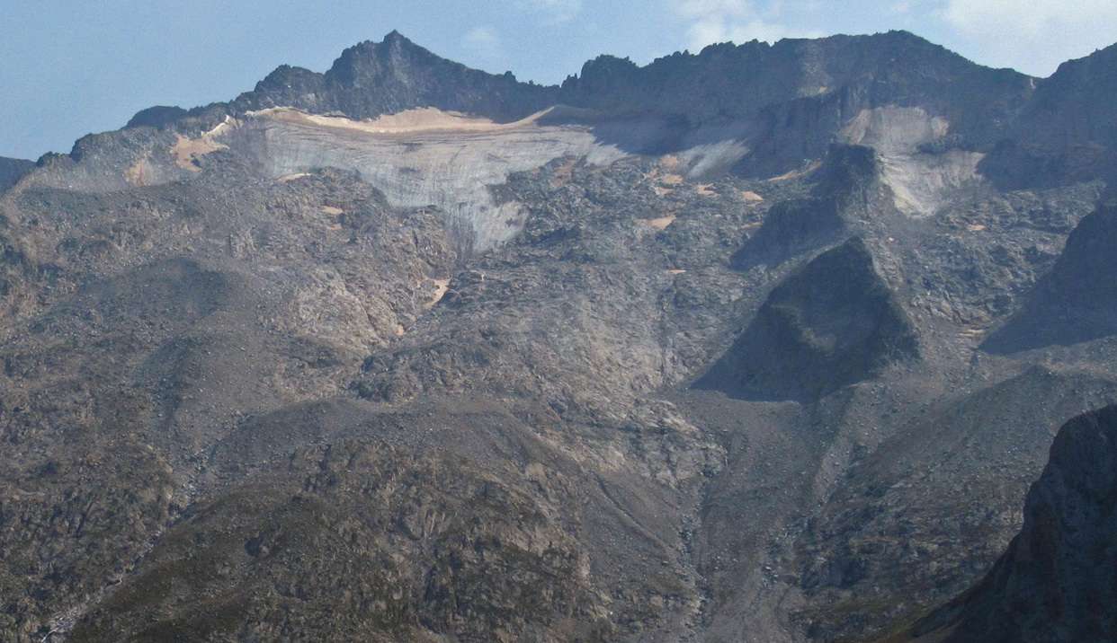
Glacier de la Maladeta in August 2021 (taken by P. René on 15/08/2021)
Terrestrial and satellite map of Maladeta glacier (Google Maps)
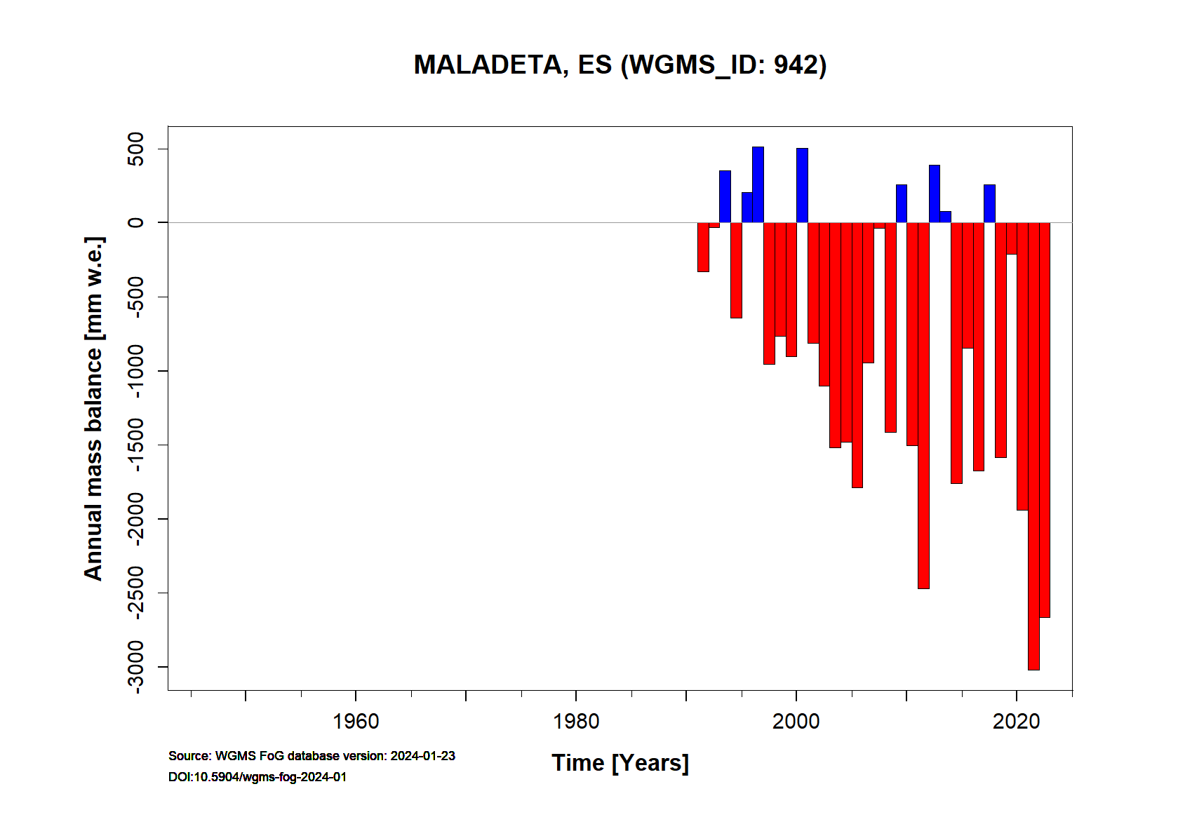
Maladeta glacier Annual Mass Balance (WGMS)
Continuous Mass Balance (MB) measurements since 1991/92:
![]()
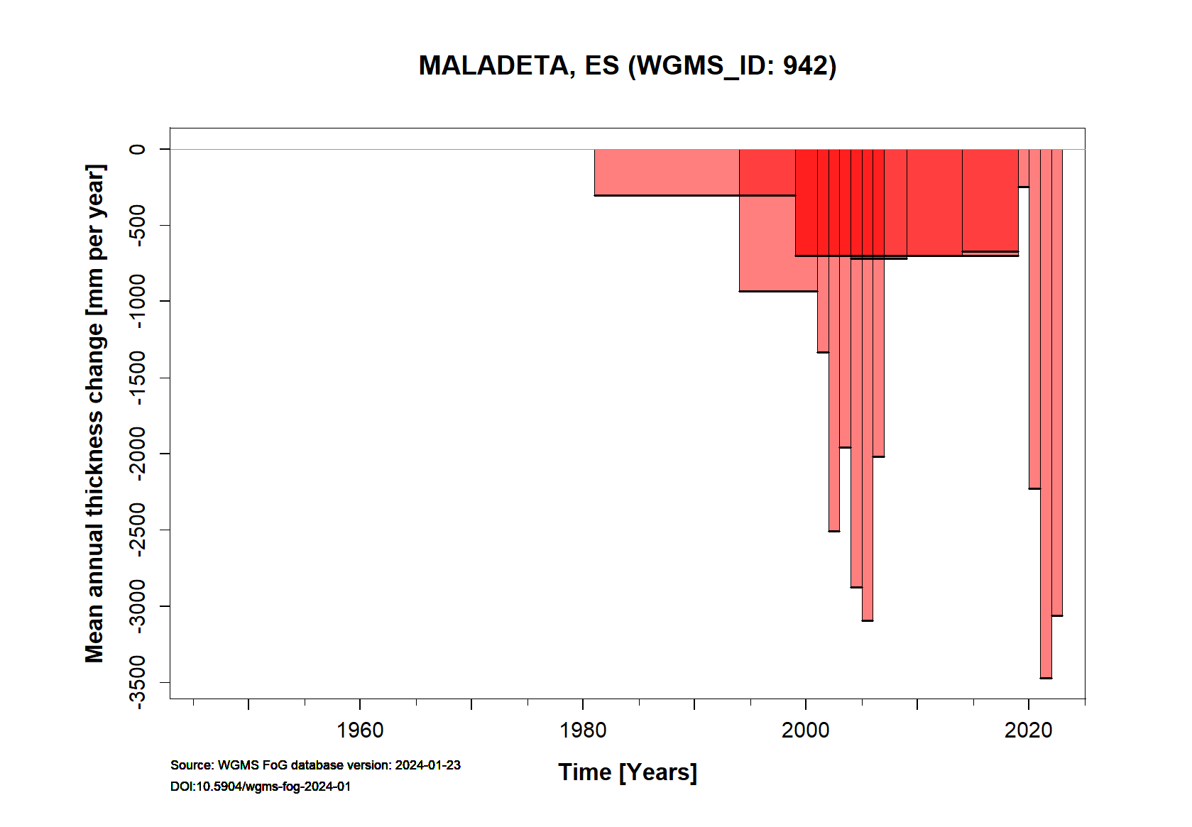
Additional data available: Front Variation (FV), Thickness Change (TC) and Glacier Outlines:


![]()