Mass Balance Factsheet for the Lemon Creek Glacier, Pacific Coast Range
Lemon Creek is a temperate valley glacier in the Juneau Icefield of Southeast Alaska, USA. This glacier has been classified as one of the ‘reference glaciers’ by the World Glacier Monitoring Service because of the continuous mass balance measurements which have been conducted since the year 1952/53. The accumulation season precipitation October-April averaged 2550 mm (2011) and the temperature during the ablation period averaged 6.5 °C (2011). For additional information on the status of the glacier and on data relating to annual mass balance and other measurements, visit the WGMS Fluctuations of Glaciers Browser.
FACTS:
- Political unit: US
- WGMS ID: 3334
- Latitude: 58.38° N
- Longitude: 134.36° W
- Height min: 820 m a.s.l.
- Height max: 1400 m a.s.l.
- Measurement types: MASS BALANCE & THICKNESS CHANGE
- Current Principal Investigator: MAURI PELTO & Colleagues
- Current Sponsoring Agency: NICOLS COLLEGE (DUDLEY, US)
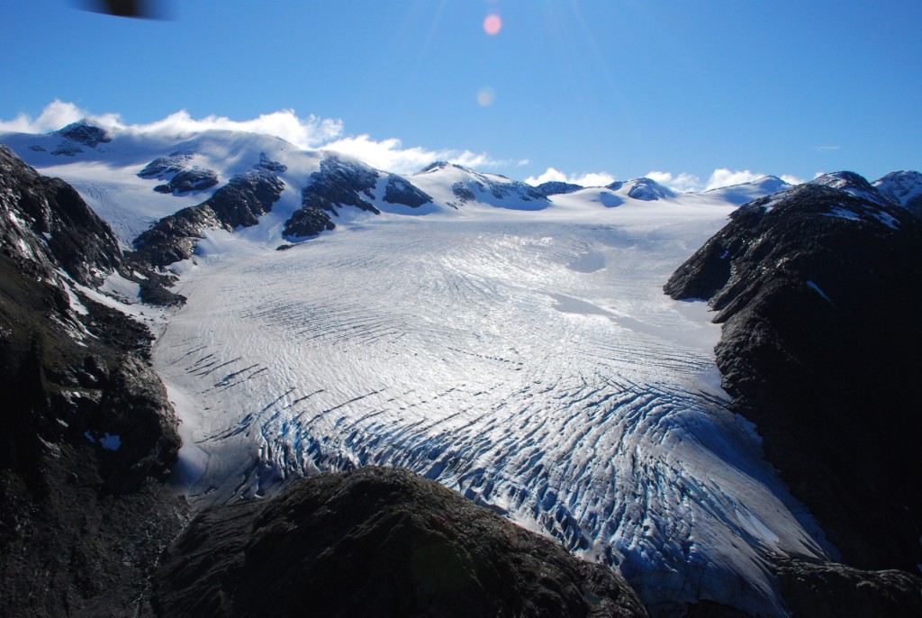
Lemon Creek in August 2007 (L. Bernier) (WGMS, 2013)
Terrestrial and satellite map of Lemon Creek Glacier (Google Maps)
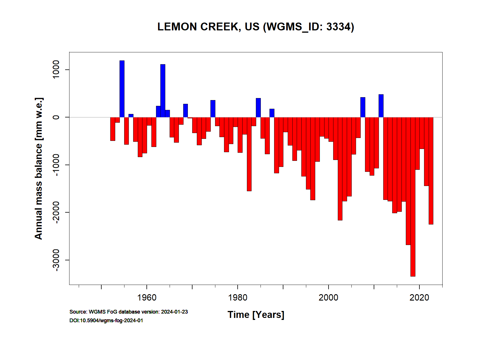
Lemon Creek Annual Mass Balance (WGMS, 2016)
Continuous Mass Balance (MB) measurements since 1952/53:
![]()
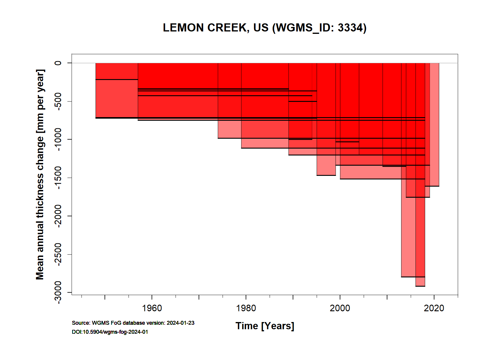
Additional data available: Thickness Change (TC) and Glacier Outlines:

![]()