Mass Balance Factsheet for the Langfjordjoekelen, Scandinavia
The Langfjordjoekelen ice cap is situated in northern Norway, approximately 60 km northwest of the city Alta. The ice cap has an area of 6 km2 and of this 2.6 km2 drains eastward. Mass balance observations and length change measurements, which started in 1989, are performed on this east-facing part. Further information and references for Langfjordjoekelen is given on NVE’s webpage.
For additional information on the status of the glacier and on data relating to annual mass balance and other measurements, visit the WGMS Fluctuations of Glaciers Browser.
FACTS:
- Political unit: NO
- WGMS ID: 323 (Local ID: 54)
- Latitude: 70.13°N
- Longitude: 21.73°E
- Height min: 338 m a.s.l.
- Height max: 1043 m a.s.l.
- Measurement types: MASS BALANCE, THICKNESS CHANGE & FRONT VARIATION
- Current Principal Investigator: BJARNE KJOLLMOEN & Colleagues
- Current Sponsoring Agency: NORWEGIAN WATER RESOURCES AND ENERGY DIRECTORATE (NVE) – SECTION FOR GLACIERS, ICE AND SNOW (OSLO, NO)
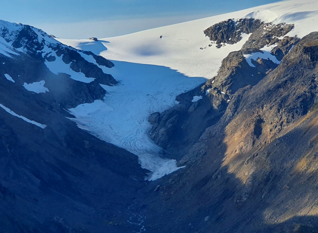
Langfjordjoekelen in September 2021 (taken by Bjarne Kjøllmoen on 18/09/2021)
Terrestrial and satellite map of Langfjordjoekelen (Google Maps)
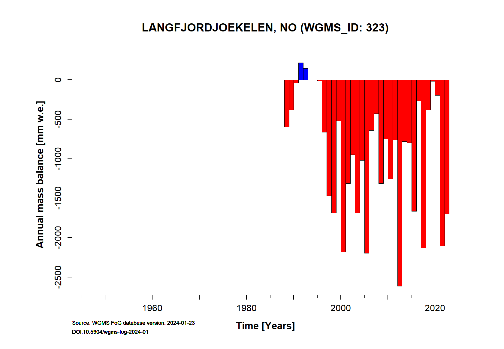
Langfjordjoekelen Annual Mass Balance
Continuous Mass Balance (MB) measurements since 1989/90:
![]()
Additional data available: Front Variation (FV), Thickness Change (TC) and Glacier Outlines:


![]()
Selected references:
NVE’s report series Glasiologiske undersøkelser i Norge/Glaciological investigations in Norway. Norwegian Water Resources and Energy Directorate. Reports are available as pdf’s at https://www.nve.no/hydrology/glaciers/glaciological-investigations-in-norway/.