Mass Balance Factsheet for the Hintereisferner, Alps
Hintereis Ferner Glacier is a valley glacier situated in the Eastern Alps of Austria. This glacier has been classified as one of the ‘reference glaciers’ by the World Glacier Monitoring Service because it has received continuous long-term observations dating back to the year 1952/53. The tongue of the glacier is located in a northeast-orientated valley and the firn area faces north, east and south. The mean air temperature (1906-2005) measured at the climate station Vent (1906 m a.s.l) was -1.6 °C and the mean annual lapse rate is 0.57 °C/100 m. For additional information on the status of the glacier and on data relating to annual mass balance and other measurements, visit the WGMS Fluctuations of Glaciers Browser.
FACTS:
- Political unit: AT
- WGMS ID: 491
- Latitude: 46.80°N
- Longitude: 10.77°E
- Height min: 2507 m a.s.l.
- Height max: 3739 m a.s.l.
- Measurement types: MASS BALANCE, THICKNESS CHANGE & FRONT VARIATION
- Current Principal Investigator: Rainer Prinz & Colleagues
- Current Sponsoring Agency: DEPARTMENT OF ATMOSPHERIC AND CRYOSPHERIC SCIENCES, UNIVERSITY OF INNSBRUCK (INNSBRUCK, AT). Supported by the HYDROGRAPHICAL SURVEY OF THE FEDERAL ADMINISTRATION OF TYROL.
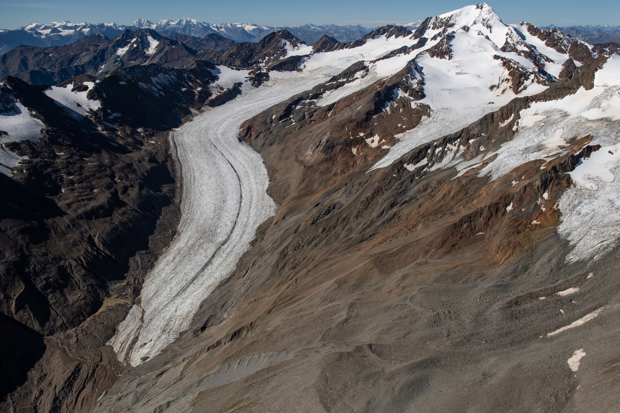
Hintereisferner in September 2020 (taken by Robbie Shone on 09/09/2020)
Terrestrial and satellite map of Hintereisferner (Google Maps)
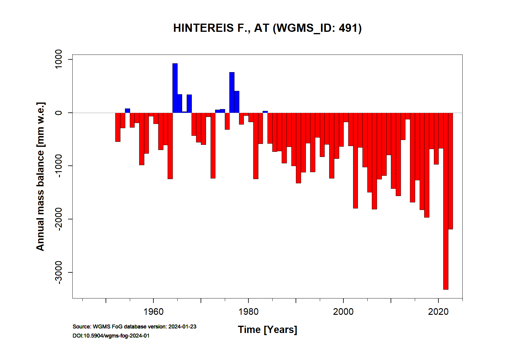
Hintereisferner Annual Mass Balance (WGMS)
Continuous Mass Balance (MB) measurements since 1952/53:
![]()
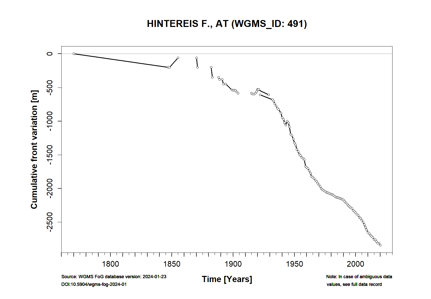
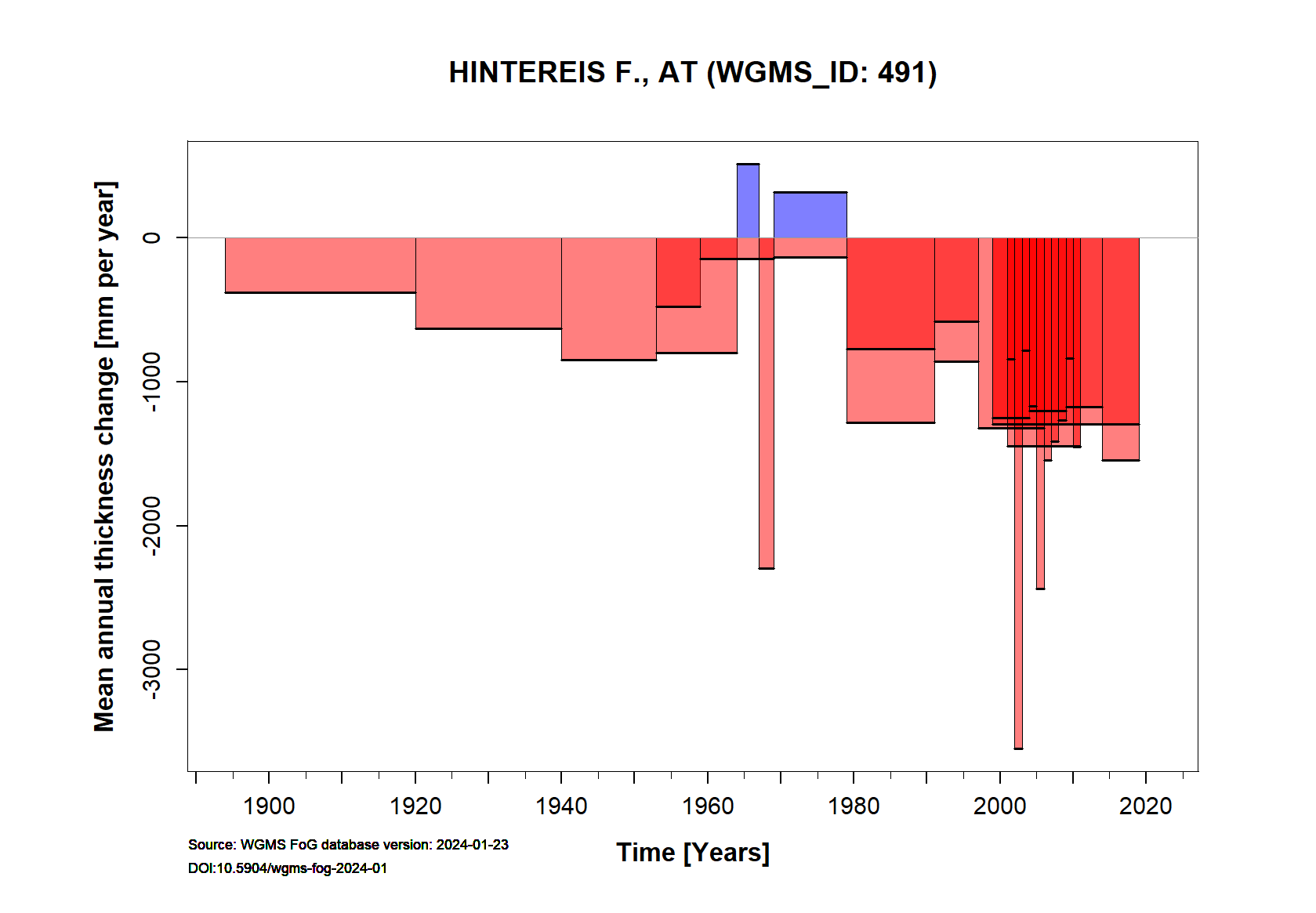
Additional data available: Front Variation (FV), Thickness Change (TC) and Glacier Outlines:


![]()
Selected references: tba