Mass Balance Factsheet for Easton Glacier, Coast Mountains
Easton Glacier flows down the south slope of Mount Baker, North Cascade Range, Washington. The glacier terminates in a valley confined by ~50 m high Little Ice Age lateral moraines. Easton Glacier extends from just below Sherman Crater at 2950 m to the terminus at 1700 m. Each summer since 1990 NCGCP has measured the mass balance of this glacier, using an extensive network of accumulation measurements (100+) and several ablation measurement sites. The accumulation measurements are completed late in the summer using probing and crevasse stratigraphy. Snowpack typically increases from the terminus to 2500 m and then remains comparatively constant. The glacier usually remains entirely snow covered until late July.
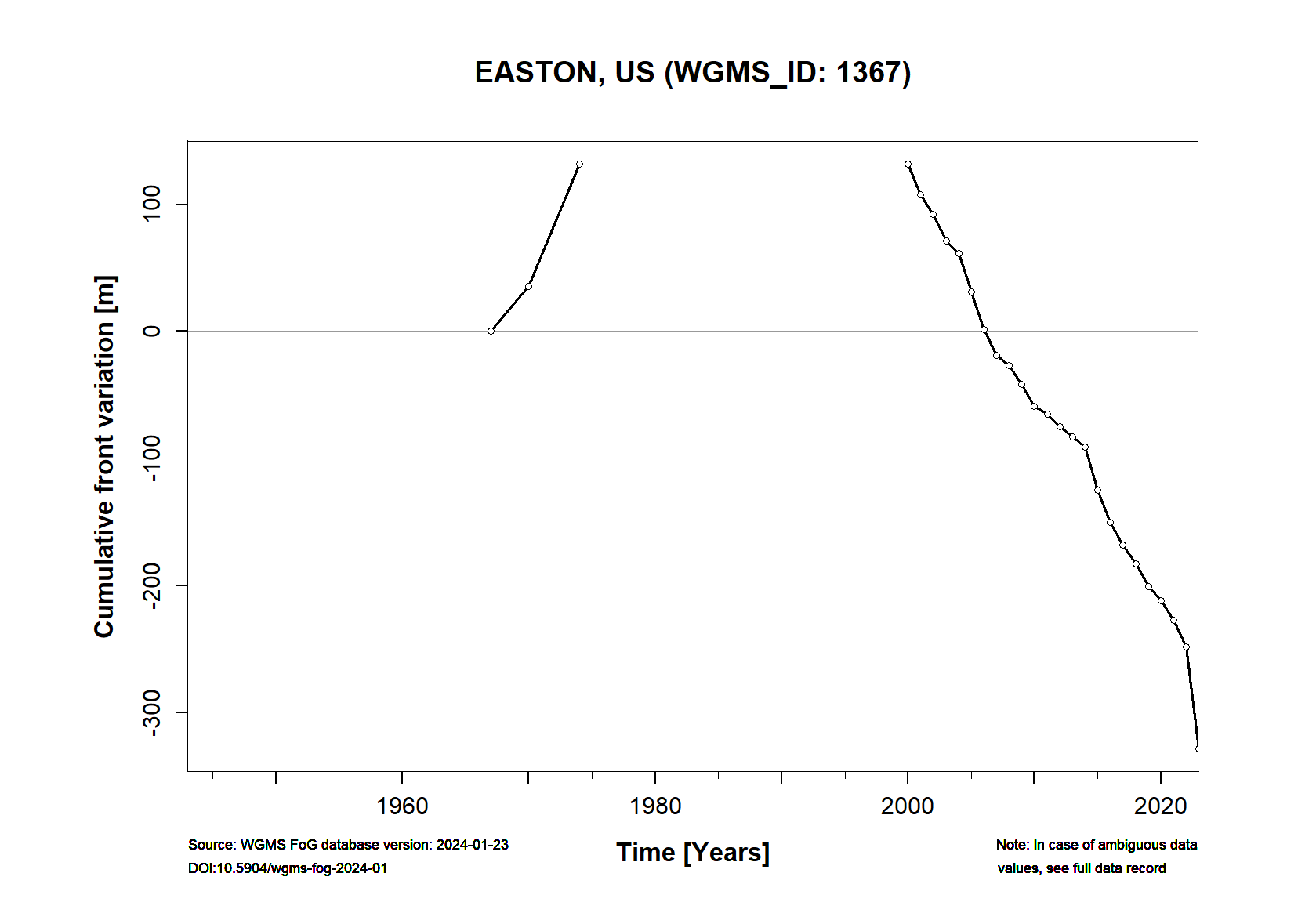
In 1907 the glacier ended at 1250 m, by 1950 the glacier had retreated 2100 m and terminated at 1625 m. The glacier started advancing after 1954 the last of the large Mount Baker glaciers to advance, advancing several hundred meters down to 1580 m by 1979. The Easton Glacier has a lower slope than the other largest glaciers on Mount Baker leading to a slower response to climate change. The glacier was in contact with the moraine emplaced by this advance until 1990 and was the last of the large Mount Baker glaciers to begin to retreat. By 2019 the glacier had retreated 405 m terminating at 1650 m and from 1990 to 2019 had a mean annual balance of -0.65 ma-1, a cumulative loss of -19.3 m. Given a thickness in 1990 between 60 and 75 m, this is about 30% of the total glacier volume. The lowest 350 m of the glacier has limited crevassing and movement indicating retreat will continue.
FACTS:
- Political unit: US
- WGMS ID: 1367
- Latitude: 48.76°N
- Longitude: 121.82°W
- Height min: 1700 m a.s.l.
- Height max: 2950 m a.s.l.
- Measurement types: MASS BALANCE & FRONT VARIATION
- Current Principal Investigator: MAURI PELTO & Colleagues
- Current Sponsoring Agency: North Cascade Glacier Climate Project (NCGCP), Nichols College (US)
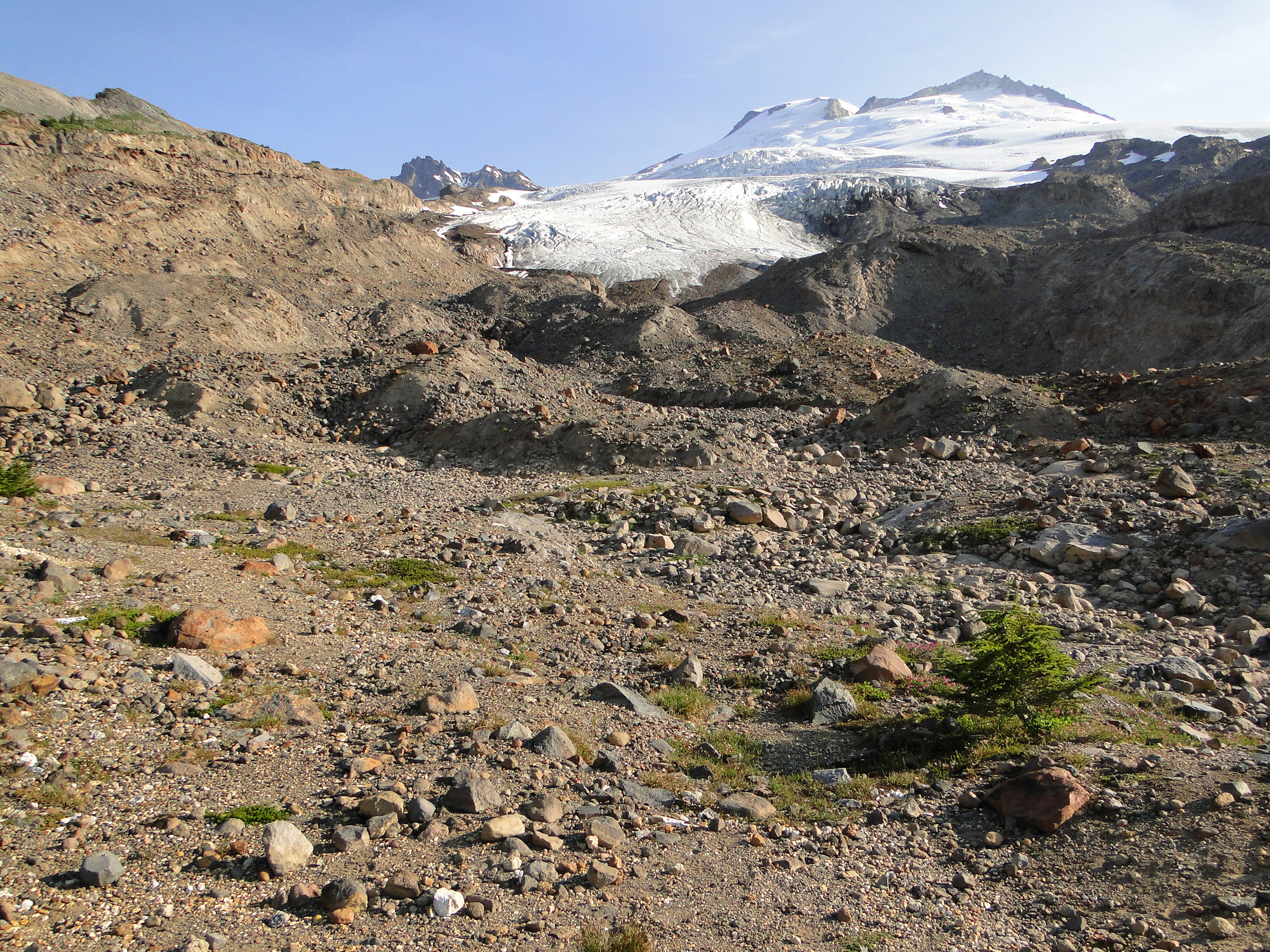
Easton Glacier in 2018 (by M. Pelto)
Satellite map of Easton Glacier (Google Maps)
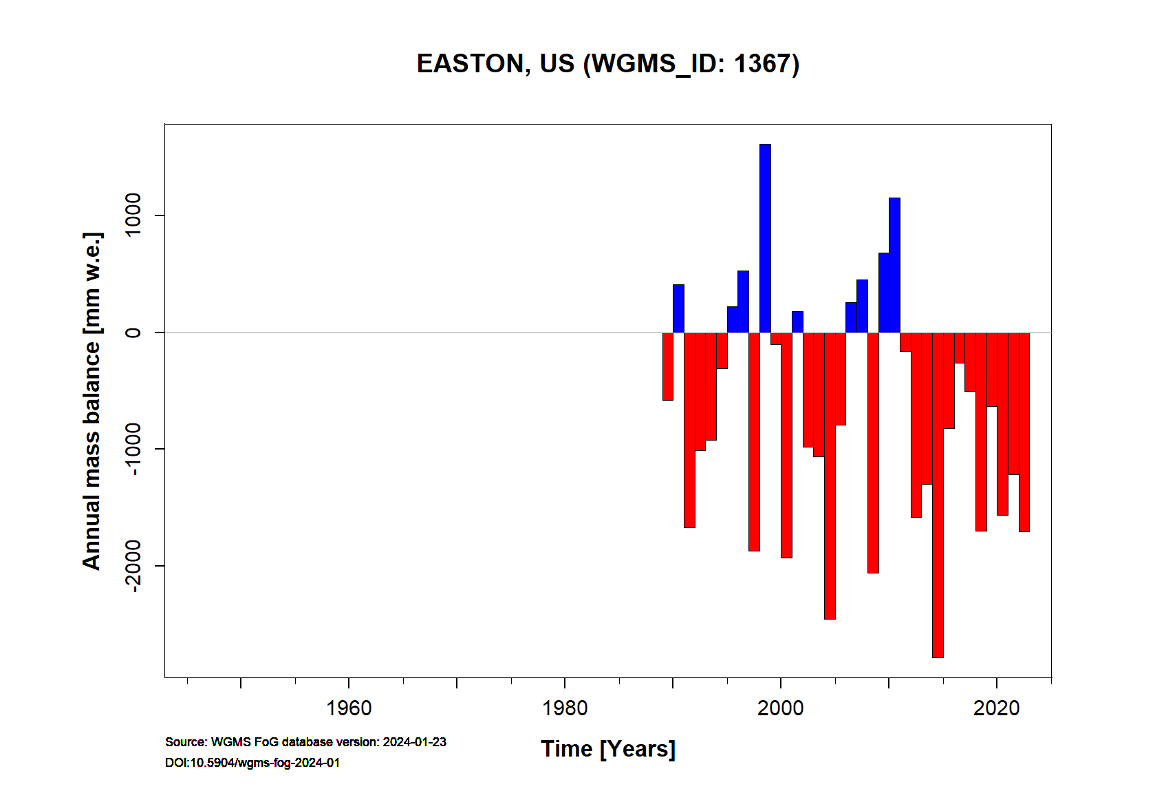
Easton Annual Mass Balance (WGMS, 2021)
Continuous Mass Balance (MB) measurements since 1989/90:
![]()
Additional data available: Front Variation (FV):