Mass Balance Factsheet for the Columbia (2057) Glacier, Pacific Coast Range
Columbia is a cirque glacier in the North Cascade Range of Washington, USA. This glacier has been classified as one of the ‘reference glaciers’ by the World Glacier Monitoring Service because of the continuous mass balance measurements which have been conducted since the year 1983/84. The accumulation season precipitation October-April averages 3400 mm and the temperature during the ablation period averages 9.2 °C. For additional information on the status of the glacier and on data relating to annual mass balance and other measurements, visit the WGMS Fluctuations of Glaciers Browser.
FACTS:
- Political unit: US
- WGMS ID: 76
- Latitude: 47.97°N
- Longitude: 121.69°W
- Height min: 1455 m a.s.l.
- Height max: 1725 m a.s.l.
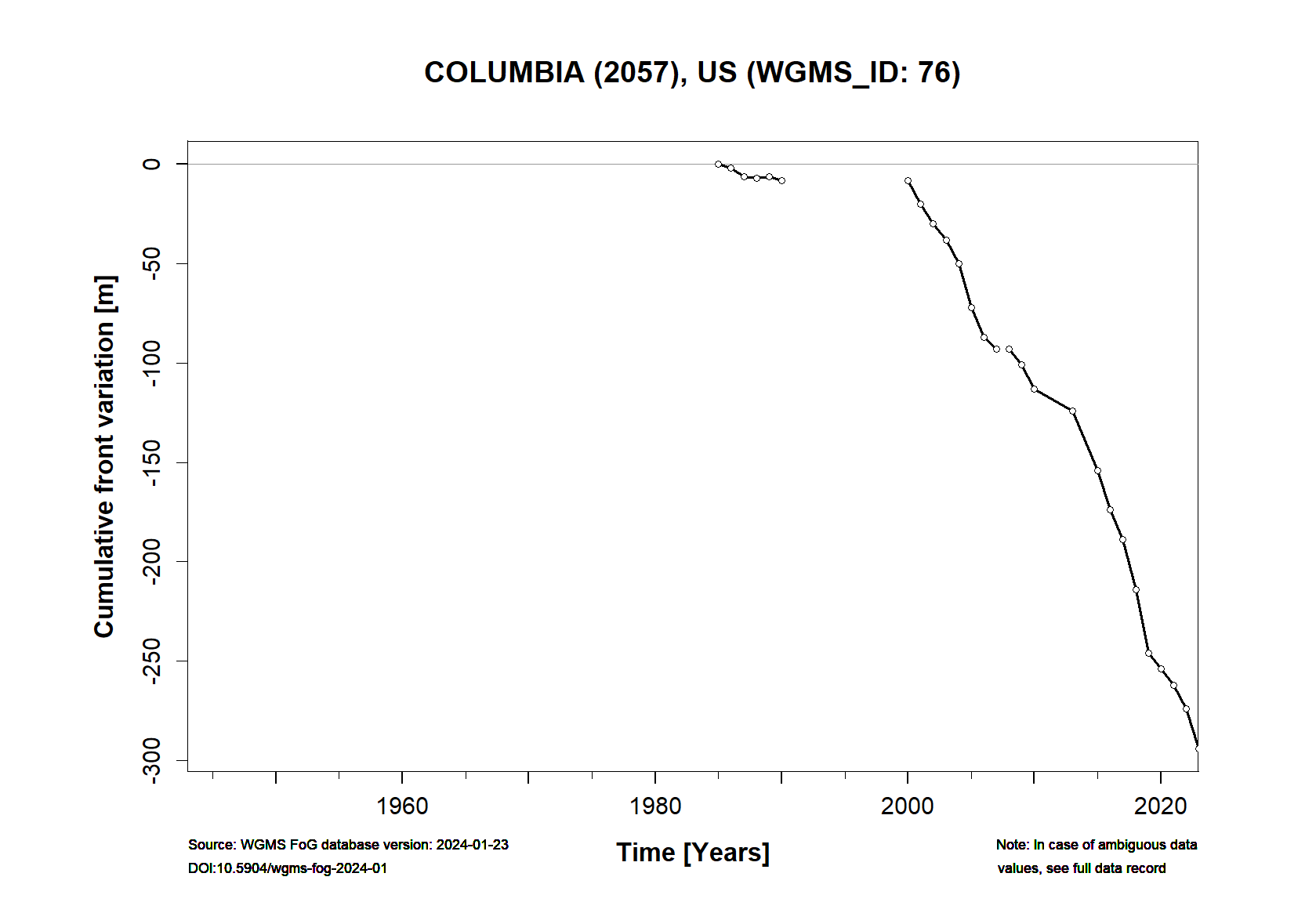
- Measurement types: MASS BALANCE & FRONT VARIATION
- Current Principal Investigator: MAURI PELTO & Colleagues
- Current Sponsoring Agency: NICOLS COLLEGE (DUDLEY, US)
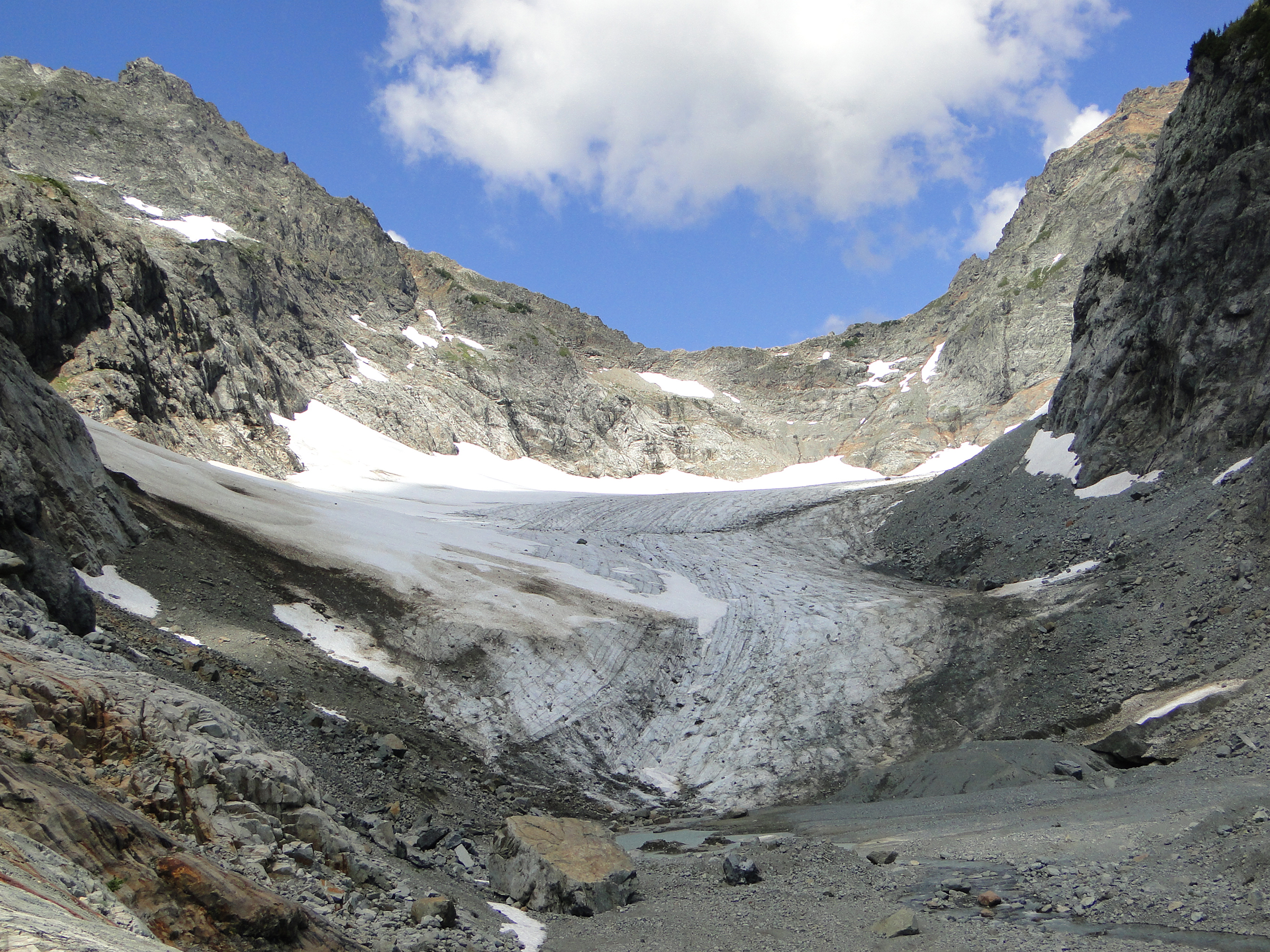
Columbia (2057) Glacier in August 2016 (taken by Mauri Pelto on 11/08/2016)
Terrestrial and satellite map of Columbia (2057) Glacier (Google Maps)
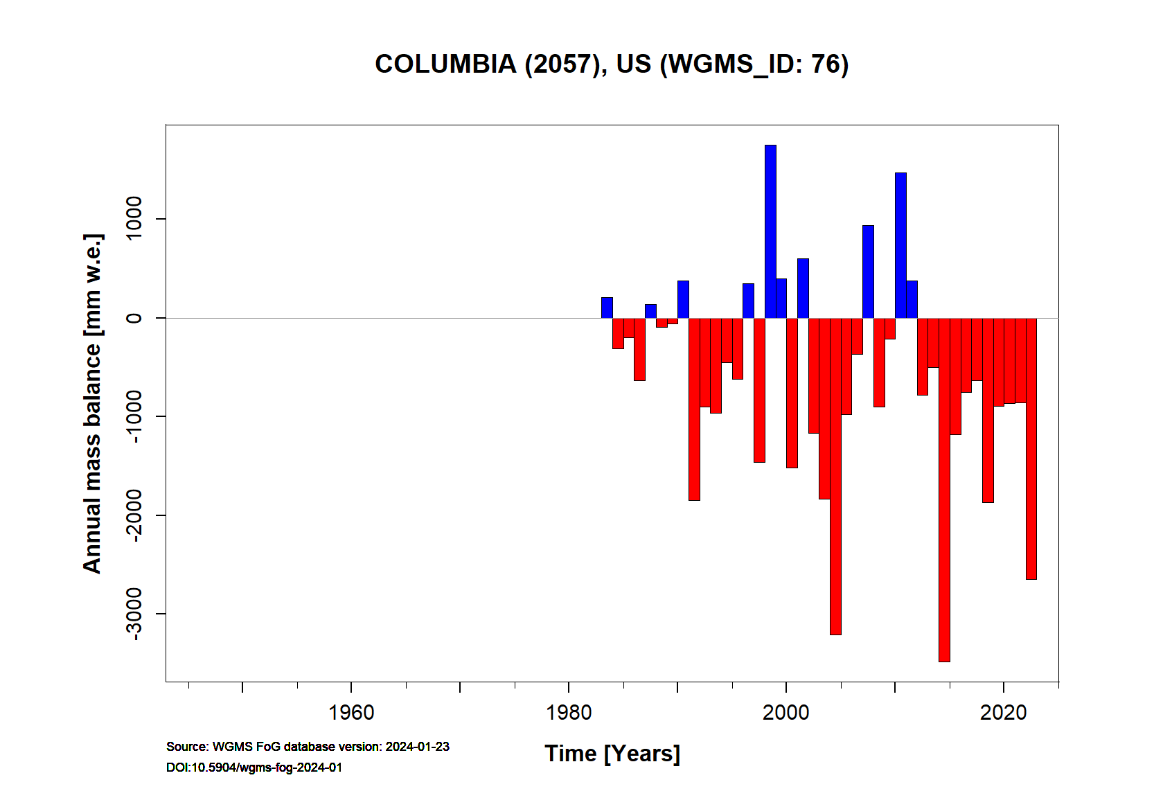
Columbia (2057) Annual Mass Balance (WGMS, 2017)
Continuous Mass Balance (MB) measurements since 1983/84:
![]()
Additional data available: Front Variation (FV):