Mass Balance Factsheet for the Careser glacier, Alps
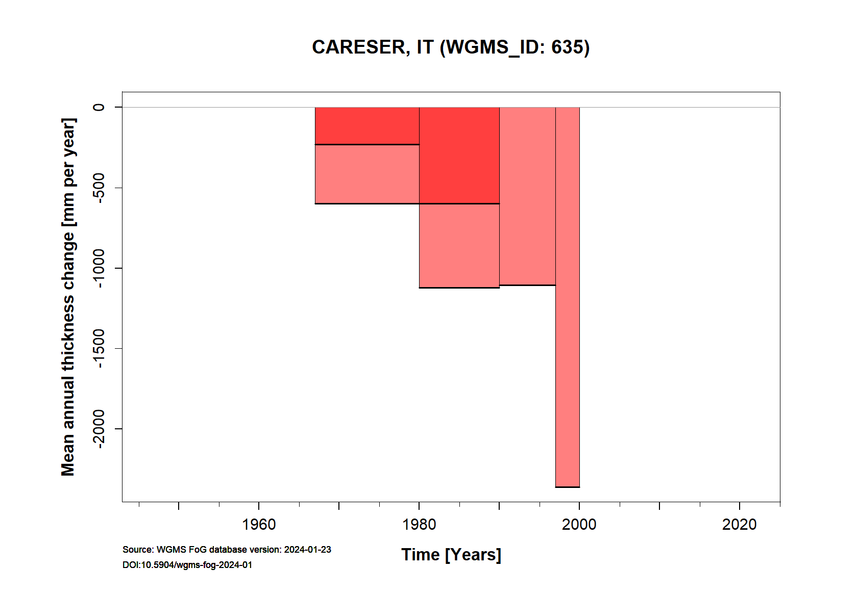
Caresèr Glacier is located in the Ortles-Cevedale group (Eastern European Alps, Italy). The glacier is exposed mainly to the south and is fairly flat. This glacier has been classified as one of the ‘reference glaciers’ by the World Glacier Monitoring Service because it has received continuous long-term observations dating back to the year 1966/67. The mean annual air temperature at this elevation is about -3 to -4 °C and annual precipitation averages 1450 mm. The mass balance was close to equilibrium until 1980, but since then it has become increasingly negative. The mean value of the annual mass balance was -1195 mm w.e. from 1981 to 2001, but decreased to -1884 mm w.e. from 2002 to 2011. This was the result of both warmer ablation seasons and positive feedbacks (decreasing albedo, surface lowering, and increased thermal emission from the growing patches of ice-free terrain). The strongly negative mass balances led to huge morphological changes in the 2000s due to widespread bedrock emersion, which is causing the disintegration of the parent glacier. For additional information on the status of the glacier and on data relating to annual mass balance and other measurements, visit the WGMS Fluctuations of Glaciers Browser.
FACTS:
- Political unit: IT
- WGMS ID: 635
- Latitude: 46.45°N
- Longitude: 10.70°E
- Height min: 2880 m a.s.l.
- Height max: 3278 m a.s.l.
- Measurement types: MASS BALANCE, THICKNESS CHANGE & FRONT VARIATION
- Current Principal Investigator: Luca Carturan & Colleagues
- Current Sponsoring Agency: SAT – COMITATO GLACIOLOGICO TRENTINO (TRENTO, IT)
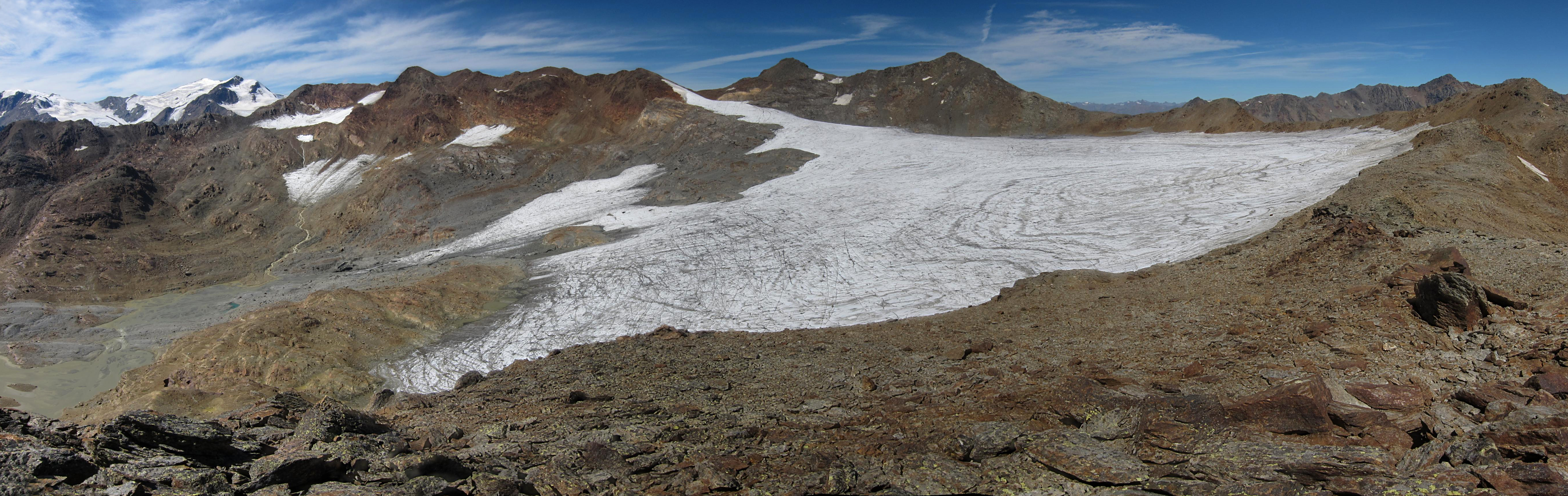
Careser glacier in August 2012 (taken by Luca Carturan on 28/08/2012)
Terrestrial and satellite map of Careser glacier (Google Maps)

Careser glacier Annual Mass Balance (WGMS, 2016)
Continuous Mass Balance (MB) measurements since 1966/67:
![]()
Additional data available: Front Variation (FV), Thickness Change (TC) and Glacier Outlines:


![]()