Mass Balance Factsheet for the Austre Broeggerbreen, Svalbard
Austre Brøggerbreen in the north-western part of Spitsbergen (Svalbard) is a valley or cirque-type glacier extending from 650 to 50 m a.s.l. Its surface has an area of 6.1 km2 (2012) and is mainly exposed to the north. The glacier is composed of more than one firn area but the mass balance measurements are carried out on the well-defined eastern part of it. Annual mean air temperature at the equilibrium line (around 300 m a.s.l.) is about -8°C and the glacier is predominantly cold, with only the deepest part being temperate. Average annual precipitation at the nearby meteorological station at Ny-Ålesund (40 m a.s.l.) is just below 400 mm. Periglacial permafrost is continuous.
For information on the status of the glacier and on data relating to annual mass balance and other measurements, visit the WGMS Fluctuations of Glaciers Browser.
FACTS:
- Political unit: SJ
- WGMS ID: 292
- Latitude: 78.88°N
- Longitude: 11.83°W
- Height min: 50 m a.s.l.
- Height max: 650 m a.s.l.
- Measurement types: MASS BALANCE & THICKNESS CHANGE
- Current Principal Investigator: JACK KOHLER & Colleagues
- Current Sponsoring Agency: NORWEGIAN POLAR INSTITUTE – POLAR ENVIRONMENTAL CENTER (TROMSO, NO)
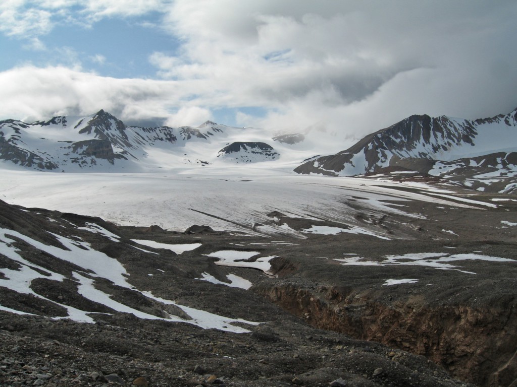
Austre Broeggerbreen in 2009 (taken by Michael Hambrey on 99/99/2009)
Terrestrial and satellite map of Austre Broeggerbreen (Google Maps)
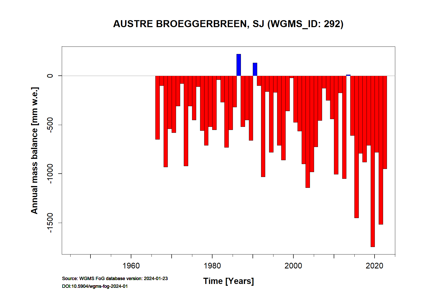
Austre Broeggerbreen Annual Mass Balance (WGMS, 2016)
Continuous Mass Balance (MB) measurements since 1966/67:
![]()
Additional data available: Thickness Change (TC) and Glacier Outlines:


![]()