Mass Balance Factsheet for the Urumqi glacier, Tien Shan
Urumqi Glacier No. 1 has been in constant recession since observations first began in 1959. Due to the retreat, the two branches of the former glacier have become separated into two small glaciers that called the East and West Branch of Glacier No. 1. According to the latest survey in September 2009, the East Branch has a total area of 1.068 km2, the highest and lowest points are at 4267 m and 3743 m a.s.l. The West Branch has a total area of 0.578 km2, with the highest and lowest points at 4484 m and 3845 m a.s.l. As a result of the survey, a 1:5000 topographic map of the glacier and its forefield is available for relevant analysis. Radio-echo sounding measurements were carried out on the glaciers in 1980, 2001 and 2006, respectively. According to the latest measurement in 2006, the maximum and mean thicknesses of the glacier are 130.0 ± 5 m and 39.4 ± 5 m, respectively.
The predominantly cold glacier is surrounded by continuous permafrost. Accumulation and ablation both primarily take place during the warm season and the formation of superimposed ice on this continental-type glacier is important. In the 2010/11 mass balance year, the precipitation at the nearby meteorological station located at 3539 m a.s.l. (Daxigou Meteorological Station; DMS) is 466 mm and 500 to 700 mm at the ELA0 of the glacier. Mean annual air temperature at DMS is –4.2 °C.
For additional information on the status of the glacier and on data relating to annual mass balance and other measurements, visit the WGMS Fluctuations of Glaciers Browser.
FACTS:
- Political unit: CN
- WGMS ID: 853
- Latitude: 43.08°N
- Longitude: 86.82°E
- Height min: 3743 m a.s.l.
- Height max: 4484 m a.s.l.
- Measurement types: MASS BALANCE & FRONT VARIATION
- Current Principal Investigator: H. Li, Z. Li & Colleagues
- Current Sponsoring Agency: COLD AND ARID REGIONS ENVIRONMENT AND ENGINEERING RESEARCH INSTITUTE, CHINESE ACADEMY OF SCIENCES
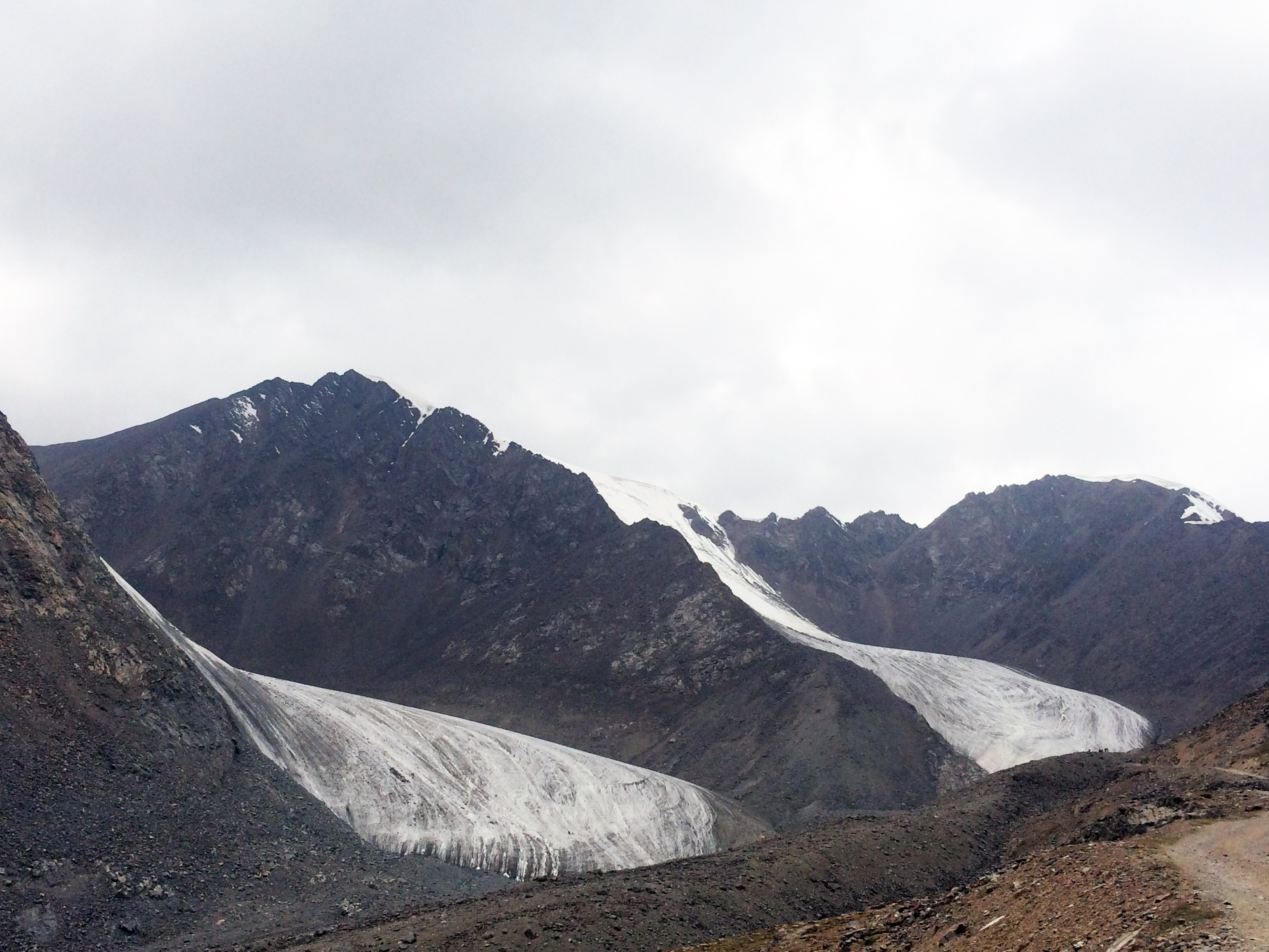
Urumqi Glacier No. 1 in August 2015 (taken by Huilin Li on 28/08/2015)
Terrestrial and satellite map of Urumqi Glacier No. 1 (Google Maps)

Urumqi Glacier No. 1 Annual Mass Balance (WGMS, 2016)
Continuous Mass Balance (MB) measurements since 1958/59:
![]()
Additional data available: Front Variation (FV) and Glacier Outlines:


![]()