Mass Balance Factsheet for the Peyto Glacier, Pacific Coast Range
…tba…
For information on the status of the glacier and on data relating to annual mass balance and other measurements, visit the WGMS Fluctuations of Glaciers Browser.
FACTS:
- Political unit:CA
- WGMS ID: 57
- Latitude: 51.67°N
- Longitude: 116.53°W
- Height min: 2100 m a.s.l.
- Height max: 3200 m a.s.l.
- Measurement types: MASS BALANCE & FRONT VARIATION
- Current Principal Investigator: MICHAEL N. DEMUTH & Colleagues
- Current Sponsoring Agency: NATURAL RESOURCES CANADA – GEOLOGICAL SURVEY OF CANADA (OTTAWA, CA)
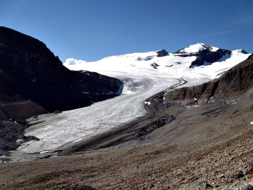
Peyto Glacier in August 2008 (taken by Eric Coulthard on 05/08/2008)
Terrestrial and satellite map of Peyto Glacier (Google Maps)
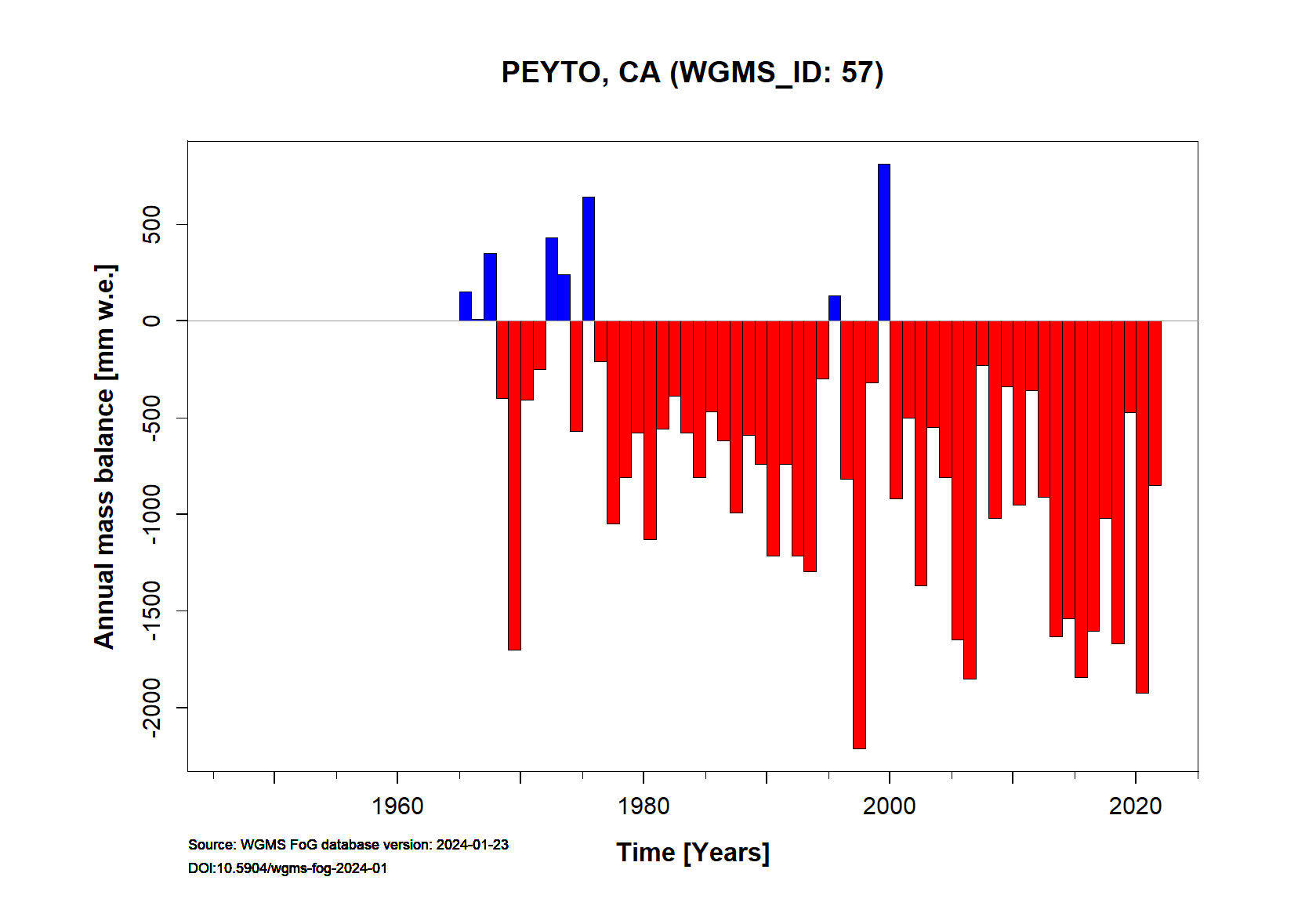
Peyto Annual Mass Balance (WGMS, 2016)
Continuous Mass Balance (MB) measurements since 1964/65:
![]()
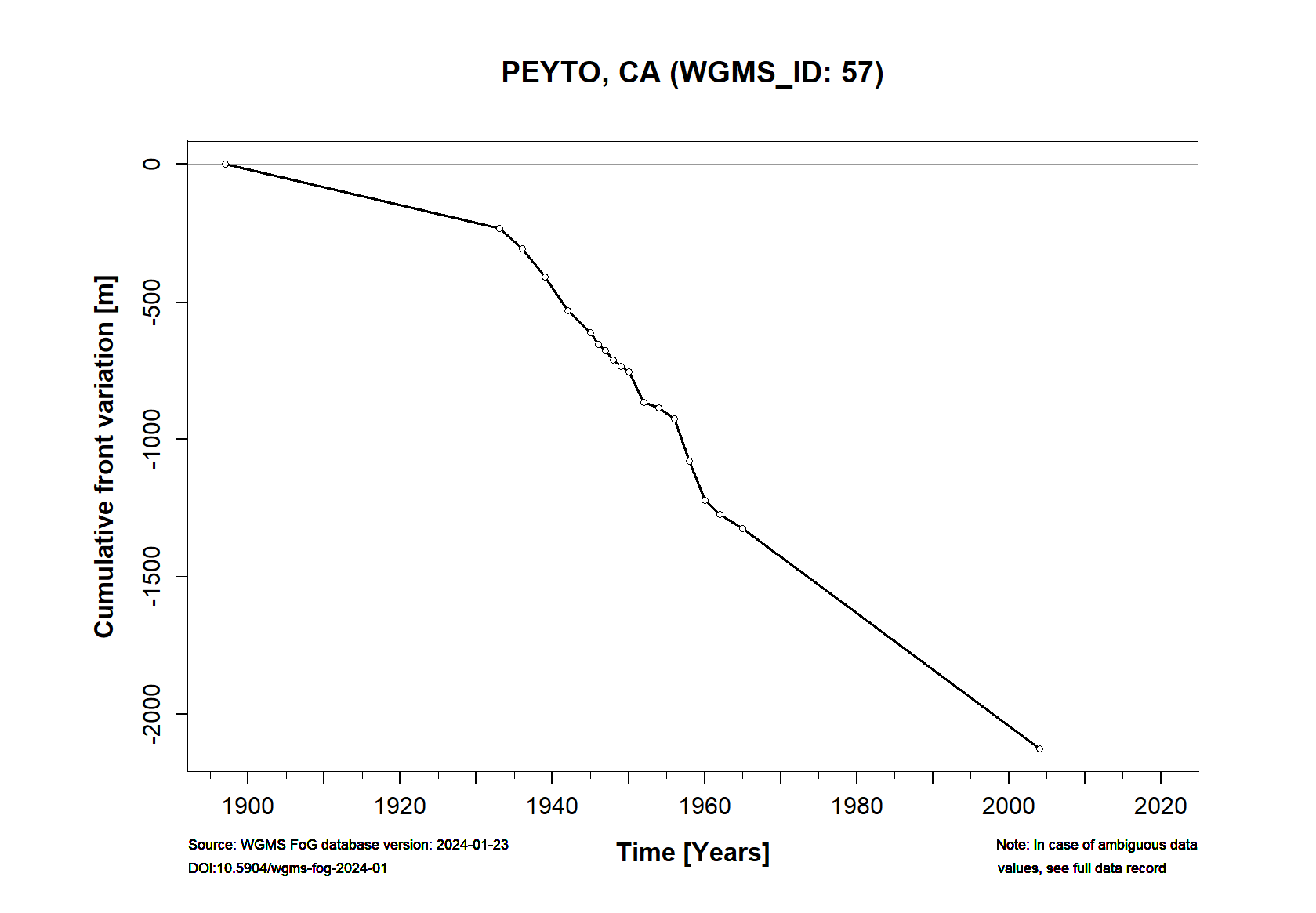
Additional data available: Front Variation (FV) and Glacier Outlines:

![]()