Mass Balance Factsheet for the Djankuat glacier, North Caucasus
The valley-type glacier is located on the northern slope of the central section of the Main Caucasus Ridge and extends from 3750 to 2700 m a.s.l. Its surface area is 3.01 km2 (in 2003) and the exposure is to the northwest. Mean annual air temperature at the ELA (ca. 3200 m a.s.l. for balanced conditions) is -3 to -4.5 °C and the glacier is temperate. Average annual precipitation as measured near the snout is 1100 to 1200 mm but roughly three times this amount at the ELA.
The peculiarity of the glacier is the migration of the ice divide on the firn plateau of the crest zone, redistributing mass flux between adjacent slopes of the main ridge.
For additional information on the status of the glacier and on data relating to annual mass balance and other measurements, visit the WGMS Fluctuations of Glaciers Browser.
FACTS:
- Political unit: RU
- WGMS ID: 726
- Latitude: 43.20°N
- Longitude: 42.77°E
- Height min: 2700 m a.s.l.
- Height max: 4000 m a.s.l.
- Measurement types: MASS BALANCE, THICKNESS CHANGE & FRONT VARIATION
- Current Principal Investigator: Victor V. Popovnin & Colleagues
- Current Sponsoring Agency: MOSCOW STATE UNIVERSITY – FACULTY OF GEOGRAPHY (MOSCOW, RU)
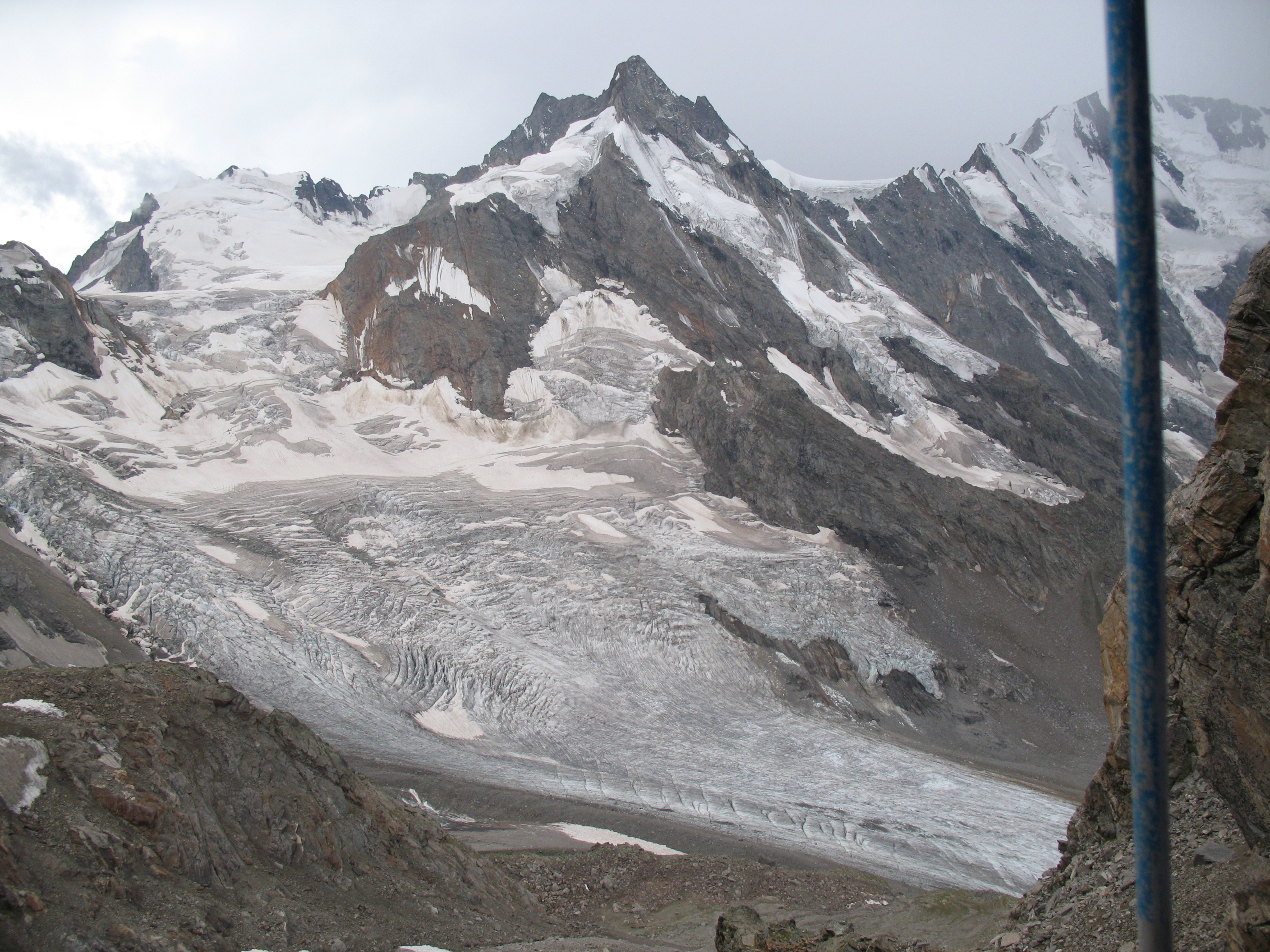
Djankuat glacier in August 2007 (taken by Victor V. Popovnin on 26/08/2007)
Terrestrial and satellite map of Djankuat glacier (Google Maps)
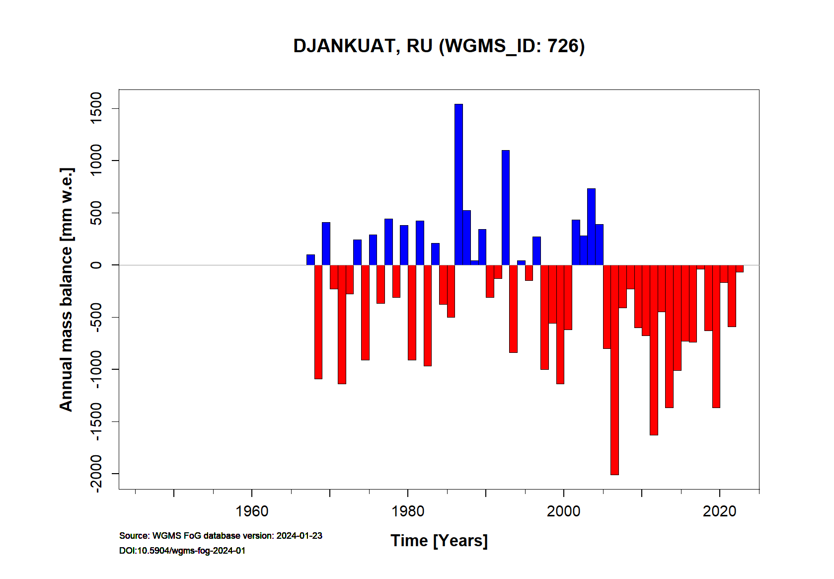
Djankuat glacier Annual Mass Balance (WGMS, 2016)
Continuous Mass Balance (MB) measurements since 1967/68:
![]()
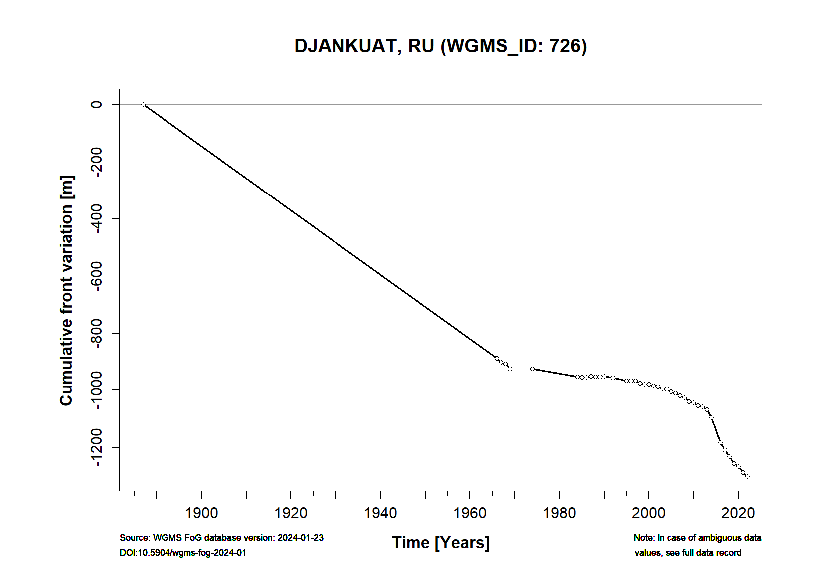
Additional data available: Front Variation (FV), Thickness Change (TC) and Glacier Outlines:


![]()