Mass Balance Factsheet for the Allalingletscher, Alps
Allalingletscher is a large valley glacier located in the southern Swiss Alps. The glacier currently covers an area of 9.6 km2 flowing in a north-east direction from 4180 m a.s.l. down to 2690 m a.s.l. (2017). The mean equilibrium line altitude is 3310 m a.s.l. and thus relatively high for the European Alps due to limited amounts of solid precipitation. Ice break-off events from the steep glacier terminus have been documented during the first years of the monitoring programme. Mass balance measurements started in 1955 connected to the construction of a reservoir for hydro-power production. Observations at between five and nine stakes are conducted and winter mass balance measurements are available between 1955 and 1996. No measurements are performed in the steep and crevassed upper part of Allalingletscher above 3400 m a.s.l. Topographic maps or photogrammetrical surveys exist for 1932, 1956, 1967, 1982, 1991, 1999, 2004, 2008 and 2012 (Bauder et al., 2007). Huss et al. (2015) re-analyzed and homogenized the seasonal stake data and ice volume changes for the period 1955 to present. Mass balance measurements are perfromed in the frame of the programme GLAMOS (Glacier Monitoring Switzerland, www.glamos.ch).
For additional information on the status of the glacier and on data relating to annual mass balance and other measurements, visit the WGMS Fluctuations of Glaciers Browser.
FACTS:
- Political unit: CH
- WGMS ID: 394
- Latitude: 46.05°N
- Longitude: 7.93°E
- Height min: 2690 m a.s.l.
- Height max: 4180 m a.s.l.
- Measurement types: MASS BALANCE, THICKNESS CHANGE & FRONT VARIATION
- Current Principal Investigator: Andreas Bauder, Matthias Huss & Colleagues
- Current Sponsoring Agency: LABORATORY OF HYDRAULICS, HYDROLOGY AND GLACIOLOGY, VAW – ETH ZURICH (ZURICH, CH)
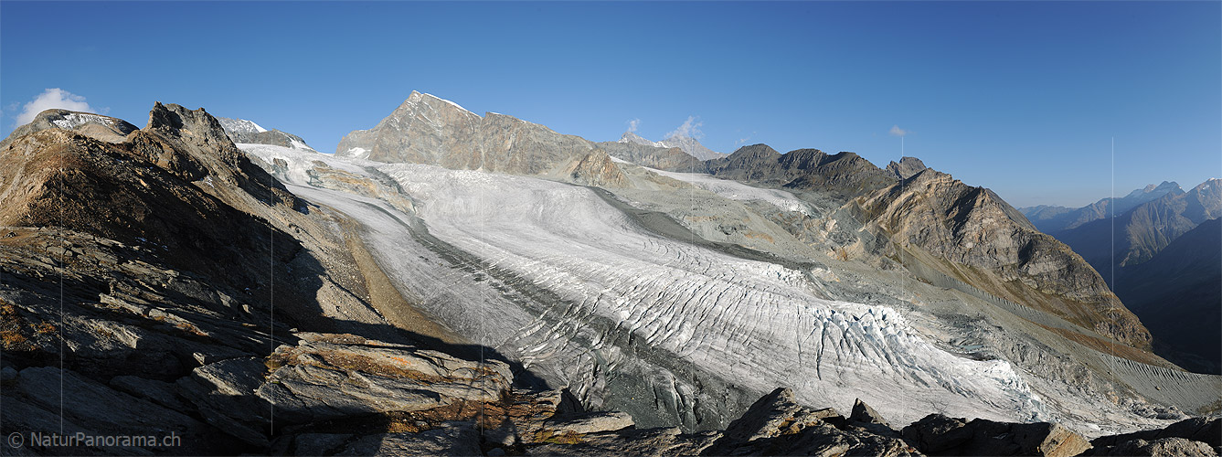
Allalin glacier in September 2012 (taken by Simon Oberli on 10/09/2012)
Terrestrial and satellite map of Allalin glacier (Google Maps)
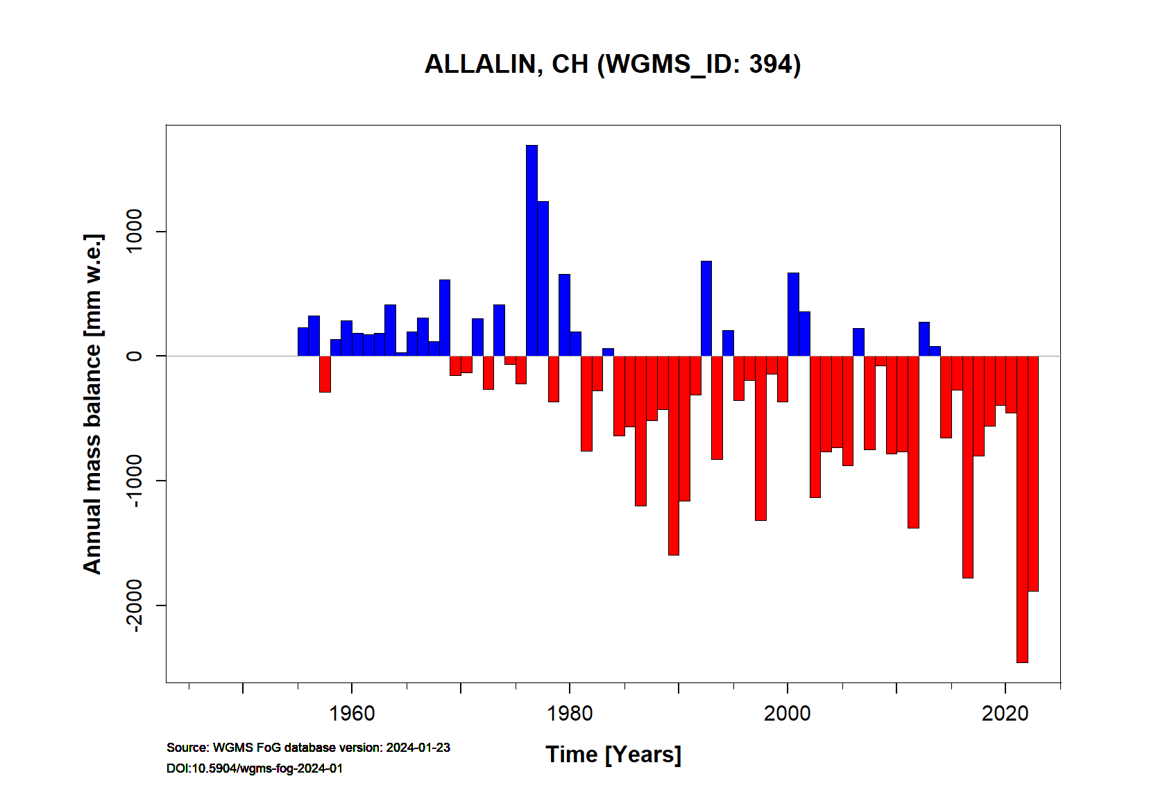
Allalin glacier Annual Mass Balance (WGMS, 2017)
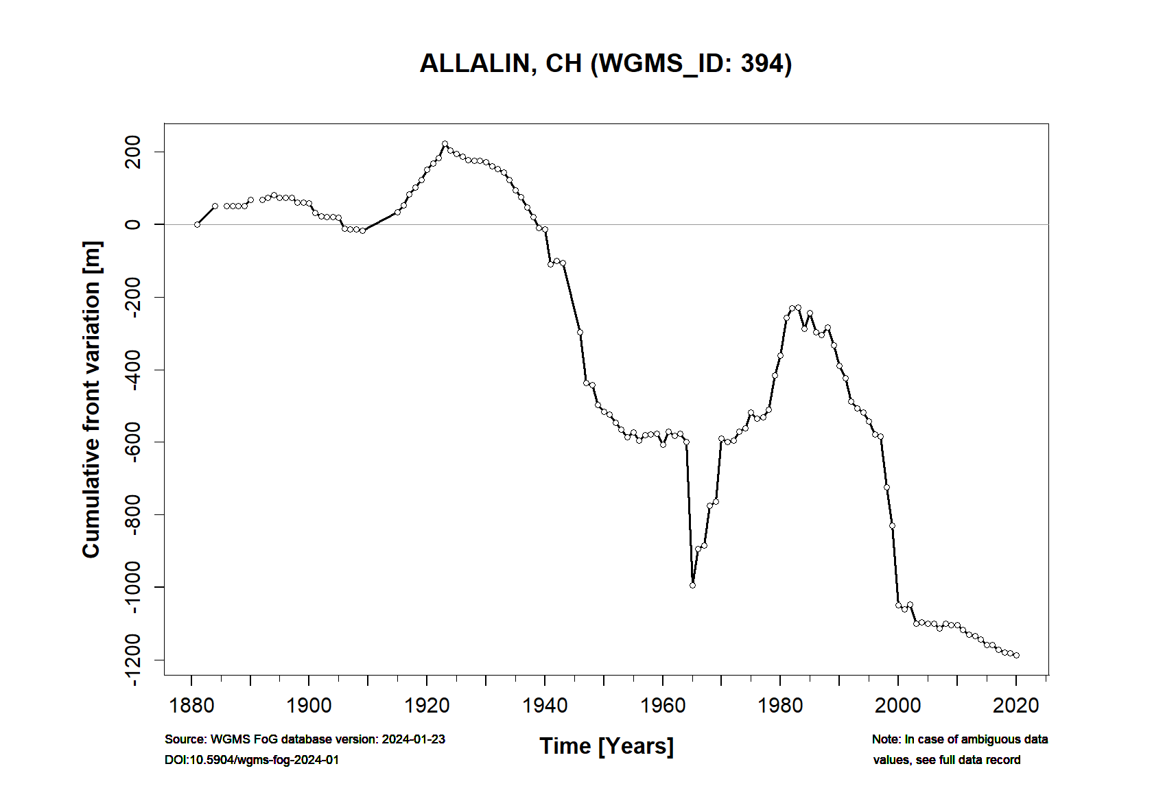
Continuous Mass Balance (MB) measurements since 1880/81:
![]()
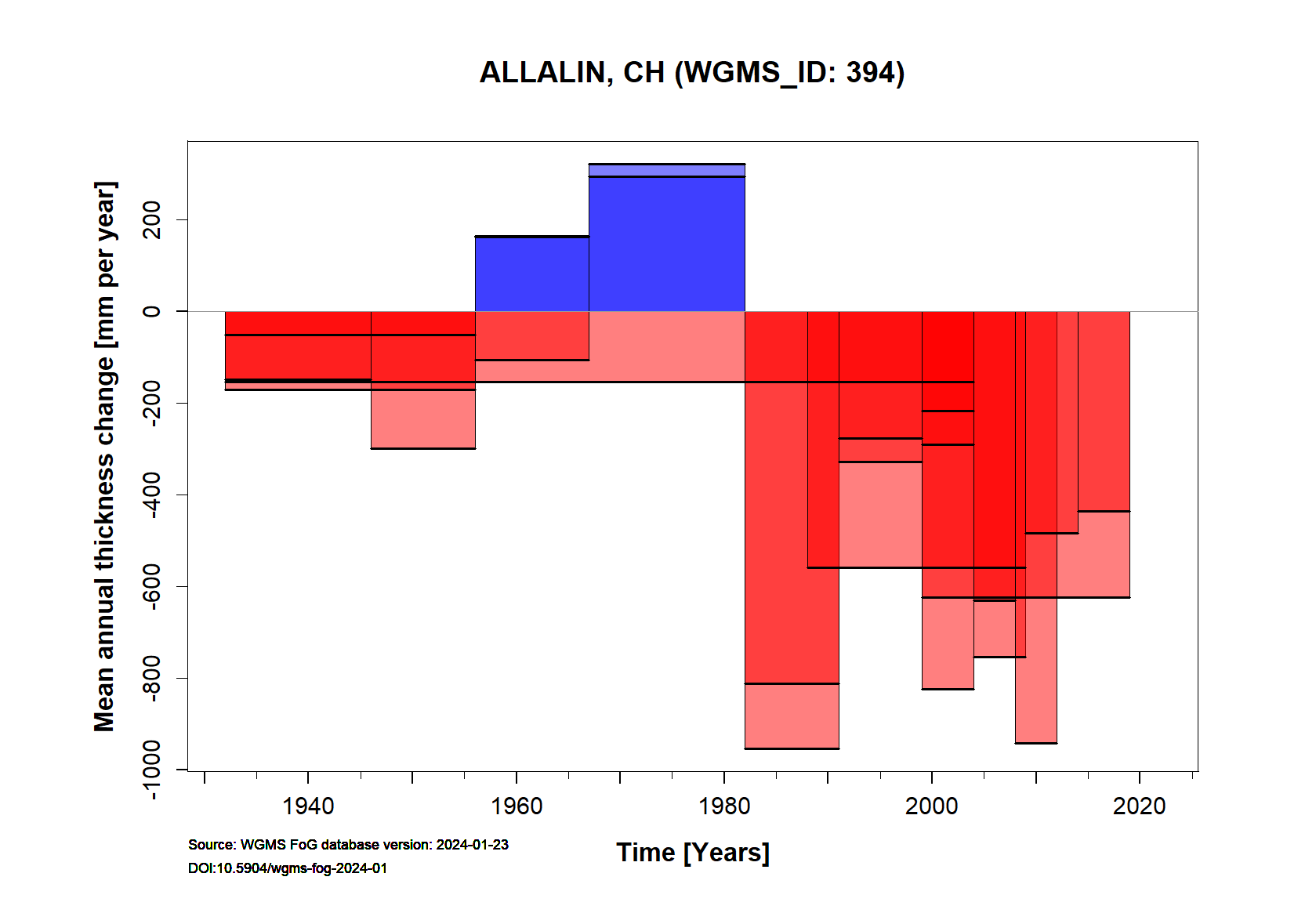
Additional data available: Front Variation (FV), Thickness Change (TC) and Glacier Outlines:


![]()
Selected references:
Bauder, A., Funk, M., & Huss, M. (2007). Ice-volume changes of selected glaciers in the Swiss Alps since the end of the 19th century. Annals of Glaciology, 46, 145-149.
Huss, M., Bauder, A., & Funk, M. (2009). Homogenization of long-term mass-balance time series. Annals of Glaciology, 50(50), 198-206.
Huss, M., Dhulst, L., & Bauder, A. (2015). New long-term mass-balance series for the Swiss Alps. Journal of Glaciology, 61(227), 551-562.